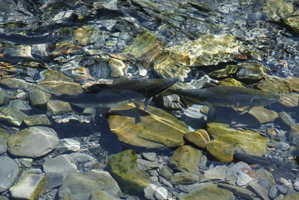
Two spawning pink salmon head upstream in shallow water in Cove Creek in Whittier on Aug. 5, 2024. Pink salmon have two-year life cycles, the shortest of all of Alaska’s five salmon species, and in recent years big pink salmon runs have alternated with smaller runs. A smaller run is expected this year, leading to a forecast of a smaller statewide commercial salmon harvest compared to last year’s total harvest of over 197 million fish. (Photo by Yereth Rosen/Alaska Beacon)
Alaska’s statewide commercial salmon harvest this year is expected to total 125.5 million fish, less than two thirds of the total landed by commercial harvesters in 2025, according to the annual forecast released last week by state biologists.
The anticipated 2026 total, detailed in Alaska Department of Fish and Game 2026 forecast and 2025 review, is lower than annual statewide harvests in all but four years since 2000, according to department records.
The lowered expectations for the statewide salmon harvest are driven mostly by anticipated declines in runs of pink salmon, also known as humpback salmon, according to the forecast.
Pink salmon are the most plentiful, smallest and cheapest of Alaska’s five salmon species. They have two-year life cycles, the shortest of all of Alaska’s salmon species. Although there are regional variations, the general pattern for the recent past is alternating big-run and smaller-run years, with 2025 as one of the big-run years.
The year-to-year difference has been significant, said Forrest Bowers, who heads the department’s commercial fishing division.
“We have been seeing a pronounced even-odd year difference in pink salmon returns, with much larger returns in odd-numbered years,” Bowers said by email.
In all, about 197.4 million salmon were harvested commercially last year, 120 million of which were pink salmon, the forecast said. This year, about 60 million pink salmon are expected to be harvested commercially, according to the forecast.
For Alaska’s other four salmon species, the forecast is for a lower total catches as well, with a combined reduction of 11% below the 2025 non-pink salmon total harvest, Bowers siad..
That is not considered a precise prediction. There are estimate ranges for different species and locations, which put the anticipated 2026 harvest in the general ballpark of last year’s harvest, except for pink salmon.
Alaska commercial salmon harvest totals from 1975 to 2024 are shown on a graph. In recent years, totals have fluctuated widely from year to year, reflecting the pattern in pink salmon returns. The 2025 total, not shown on the graph, was over 197 million fish, putting it among the top years in the past five decades for salmon numbers. (Graph provided by the Alaska Department of Fish and Game)
“When we consider forecast uncertainty and the distribution of harvests across the state, the forecast for non-pink salmon is fairly similar to the 2025 actual harvest,” Bowers said.
Sockeye salmon, also known as red salmon, is the second-most plentiful of Alaska’s five species, and the statewide harvest is dominated by Southwestern Alaska’s Bristol Bay, site of the world’s largest sockeye salmon runs.
That status will continue this year, according to the forest. Bristol Bay’s estimated 2026 harvest for this year is 33.5 million fish, a little over the average over the last 20 years — but smaller than in some recent years, when harvests in that region hit or approached records. Last year’s Bristol Bay sockeye harvest was about 41.2 million fish, a little more than three quarters of the statewide sockeye harvest.
This year, the statewide sockeye salmon harvest is forecasted to total 49.7 million fish, of which about two thirds are expected to come from Bristol Bay.
The forecasted chum salmon commercial harvest this year is 17.2 million fish, compared to 21.7 million last year. This year’s forecasted harvest of coho salmon, also known as silver salmon, is 2.4 million fish, compared to 2.7 million harvested last year. This year’s forecasted harvest of Chinook salmon, also known as king salmon, is 197,000 fish, compared to last year’s total harvest of 201,000 fish.
The department’s forecast details regional differences along with species differences.
In the Yukon and Kuskokwim river systems, salmon runs are expected to continue to be weak, as they have been for the past several years, according to the forecast. There is no commercial fishing anticipated on either of those river systems. The only commercial fishing in the Arctic-Yukon-Kuskokwim region is expected to be in Norton Sound and in the Kotzebue area, as was the case last year and in other recent years.
The newly released forecast is for commercial harvesting alone. It does not include subsistence or sports harvests. Reports detailing last year’s subsistence harvests are expected to be released in the future, the forecast said.
Pink salmon are seen in an undated photo. Male pink salmon develop humps on their backs, and the fish are also known as humpback salmon or “humpies.”(Photo provided by the National Oceanic and Atrmospheric Administration Fisheries Service)
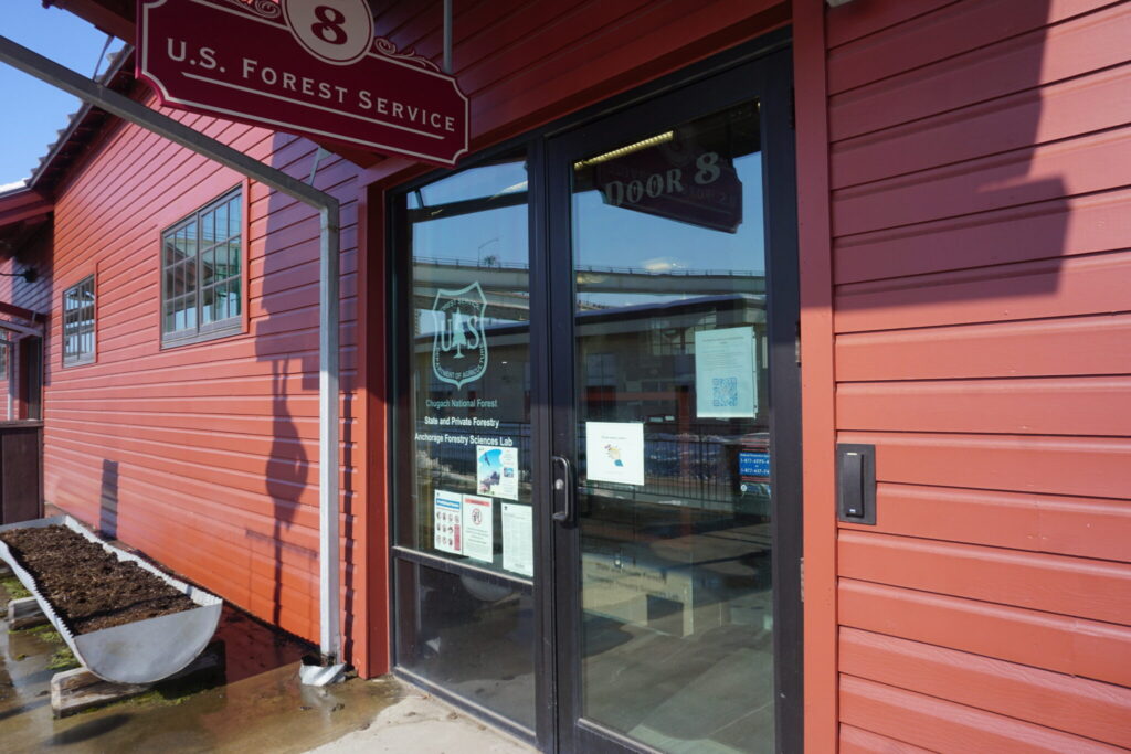
The entrance to the Anchorage Forestry Science Laboratory is seen on April 2, 2026. The lab serves state agencies, Native corporations and private industry as well as federal agencies. The lab, in Anchorage’s Ship Creek neighborhood, is on a list of U.S. Forest Service facilities that the Trump administration plans to close. (Photo by Yereth Rosen/Alaska Beacon)
Two weeks after the Trump administration announced a U.S. Forest Service “restructuring” that would close regional offices and most of the agency’s research facilities, impacts to Alaska – home to the two largest U.S. national forests – remain unclear.
The U.S. Department of Agriculture announced on March 31 that the Forest Service’s national headquarters will move to Utah and that many of its facilities will be shuttered. Among the facilities on the closure list were two that are important to Alaska: the and the Oregon-based in Portland.
But other impacts on the 17-million-acre Tongass National Forest and the 5.4-million-acre Chugach National Forest were not disclosed.
A statement from the Forest Service headquarters provided few details about the Tongass, the Chugach or the visitor and recreational facilities located in either forest.
“The transition will occur in phases. Employees will receive clear information about relocation timelines, available options, and resources to support their decisions,” the statement said. “The number of relocations beyond those already identified in the National Capital Region is unknown at this time.”
U.S. Agriculture Department Secretary Brooke Rollins, whose department oversees the Forest Service, outlined the restructuring plan last year. In a July 24, 2025, memo, she said the plan included the replacement of the Alaska regional office with “a reduced state office in Juneau.” The state capital is currently the site of the Alaska regional office managing both the Tongass and the Chugach.
Three people at Begich, Boggs Visitor Center in the Chugach National Forest look out at Portage Lake on Aug. 30, 2025. The U.S. Forest Service’s visitor center, a popular tourist destination, used to provide a close-up view of Portage Glacier’s ice. Now the glacier has retreated so much that it is around the right corner, requiring a boat ride or mountain hike to see it in summer. A bit of Burns Glacier, which has also retreated dramatically, is visible from the visitor center. (Photo by Yereth Rosen/Alaska Beacon)
Alaska has Forest Service facilities throughout the Tongass and Chugach regions, from the southern tip of the Southeast to Anchorage.
Sen. Lisa Murkowski, R-Alaska, is also trying to learn about impacts to Alaska, a spokesperson said.
The senator and her staff are in a “fact-finding” mode and preparing to mount a “defense of the Forest Service in Alaska and make sure the employees are able to continue the good work that they’re currently doing,” said Murkowski spokesperson Joe Plesha.
The issue is expected to be managed through the Congressional appropriations process, Plesha said.
Murkowski is on the Senate Appropriations Committee and chairs the appropriations subcommittee on the Department of the Interior, Environment and Related Agencies.
The Anchorage lab that is scheduled for closure is located in the Ship Creek district of downtown Anchorage. It supports research in the Tongass National Forest, which is the nation’s largest, and the Chugach National Forest, the second largest. It also supports research on forests elsewhere, from the boreal forests of Interior Alaska to those on tiny tropical Pacific islands like Guam and Micronesia.
The lab is used not just by Forest Service scientists but by other federal agencies, state agencies, Native corporations, University of Alaska researchers and private industry, according to its website.
Tourists walk to and from a viewpoint at the Mendenhall Glacier visitor center on May 14, 2025. The visitor center in the Tongass National Forest is a top tourist destination. (Photo by Yereth Rosen/Alaska Beacon)
Up to now, the lab has had a year-round staff of about 22 scientists and administrative workers, but the numbers increase during summer field seasons.
The planned closure of the century-old Pacific Northwest Research Station in Oregon is part of a consolidation of research functions into a single site in Fort Collins, Colorado.
The Pacific Northwest facility, with about 250 employees, has an affiliated lab in Juneau. The fate of the Juneau lab remains unknown.
Among the Alaska projects undertaken by the Pacific Northwest Research station, sometimes with partner organizations, is study of the decline of yellow cedar in the Tongass and adjacent regions in the southeastern part of the state; the status of birds and rare plants in the Tongass; the study of rural Alaskans’ access to wild foods in the Chugach National Forest and the surrounding region; and the monitoring of human recreation’s impacts on brown bears.
The Forest Service closure plans follow deep cuts already made by the Trump administration’s Department of Government Efficiency, or DOGE. In the first half of 2025, the Forest Service lost 5,860 of its 35,550 employees, according to a Dec. 17, 2025, report by the Agriculture Department’s inspector general.
That includes losses in Alaska. As of January, Alaska’s Forest Service workforce was down to 467 from the total of about 700 before the DOGE-imposed cuts began, KTOO reported in January.
An exploration site at ConocoPhillips’ Willow prospect is seen from the air in the 2019 winter season. Willow is located in the National Petroleum Reserve in Alaska. (Photo by Judy Patrick/provided by ConocoPhillips Alaska Inc.)
The White House announced Friday evening that Trump had signed Senate Joint Resolution 80 into law.
SJR 80 uses the Congressional Review Act to reverse restrictions enacted during the administration of President Joe Biden. Those restrictions, imposed as part of a 2022 activity plan for the reserve, were intended to protect environmentally sensitive areas against harm from oil and gas drilling.
Developers and drilling advocates opposed the restrictions, saying they could deter work that would provide revenue for local residents and Alaskans at large. Trump has also been interested in developing Alaska’s oil reserves as part of a broader effort to increase American energy production and reduce imports.
ConocoPhillips’ Willow project is in the northeast corner of the National Petroleum Reserve-Alaska. (Map by USGS, Department of Interior)
The National Petroleum Reserve-Alaska is approximately 23.5 million acres. Located to the west of Alaska’s vast Prudhoe Bay oil fields it — unlike the Arctic National Wildlife Reserve to the east — has been the subject of interest from oil companies.
ConocoPhillips’ Willow Project, approved during the Biden administration, was the first major project to take place in the reserve, and others are planned.
Friday’s signing was one of several Trump administration actions taking place simultaneously to reduce regulatory obstacles for developers interested in drilling within the reserve.
Homes are surrounded by debris in Kwigillingok, Alaska, Monday, Oct. 27, 2025, after being damaged earlier in the month by Typhoon Halong. (AP Photo/Lindsey Wasson)
AP- Storms that battered Alaska’s western coast this fall have brought renewed attention to low-lying Indigenous villages left increasingly vulnerable by climate change — and revived questions about their sustainability in a region being reshaped by frequent flooding, thawing permafrost and landscape-devouring erosion.
The onset of winter has slowed emergency repair and cleanup work after two October storms, including the remnants of Typhoon Halong, slammed dozens of communities. Some residents from the hardest-hit villages, Kipnuk and Kwigillingok, could be displaced for months and worry what their futures hold.
Kwigillingok already was pursuing relocation before the latest storm, but that can take decades, with no centralized coordination and little funding. Moves by the Trump administration to cut grants aimed at better protecting communities against climate threats have added another layer of uncertainty.
Still, the hope is to try to buy villages time to evaluate next steps by reinforcing rebuilt infrastructure or putting in place pilings so homes can be elevated, said Bryan Fisher, the state’s emergency management director.
“Where we can support that increased resilience to buy that time, we’re going to do that,” he said.
Many Alaska Native villages are threatened by climate change
Alaska is warming faster than the global average. A report released last year by the Alaska Native Tribal Health Consortium found 144 Native communities face threats from erosion, flooding, thawing permafrost or a combination.
Coastal populations are particularly vulnerable, climate scientist John Walsh said. Less Arctic sea ice means more open water, allowing storm-driven waves to do damage. Thawing permafrost invites more rapid coastal erosion. Waves hitting permafrost bounce like water off a concrete wall, he said, but when permafrost thaws, the loose soil washes away more easily.
Wind and storm surge from the remnants of Halong consumed dozens of feet of shoreline in Quinhagak, disturbing a culturally significant archaeological site. Quinhagak, like Kipnuk and Kwigillingok, is near the Bering Sea.
Just four times since 1970 has an ex-typhoon hit the Bering Sea coast north of the Pribilof Islands, said Rick Thoman, a climate specialist with the Alaska Center for Climate Assessment and Preparedness. Three of those have been since 2022, starting with the remnants of Merbok that year.
The damage caused by ex-typhoon Halong was the worst Fisher said he has seen in his roughly 30 years in emergency management. About 700 homes were destroyed or severely damaged, estimates suggest. Some washed away with people inside and were carried for miles. Kipnuk and Kwigillingok — no strangers to flooding and home to around 1,100 people — were devastated. One person died, and two remain missing.
Some homes and buildings that were torn off their foundations and floated away are seen near the village of Kwigillingok, Alaska, Monday, Oct. 27, 2025, after Typhoon Halong hit the region earlier in the month. (AP Photo/Lindsey Wasson)
Options are limited and expensive
At-risk communities can reinforce existing infrastructure or fortify shoreline; move infrastructure to higher ground in what is known as managed retreat; or relocate entirely. The needs are enormous — $4.3 billion over 50 years to protect infrastructure in Native communities from climate threats, according to the health consortium report, though that estimate dates to 2020. A lack of resources and coordination has impeded progress, the report found.
Simply announcing plans to relocate can leave a community ineligible for funding for new infrastructure at their existing site, and government policies can limit investments at a new site if people aren’t living there yet, the report said.
It took decades and an estimated $160 million for the roughly 300 residents of Newtok in western Alaska to move 9 miles (14.5 kilometers) to their new village of Mertarvik. Newtok was one of the first Alaska Native communities to fully relocate, but others are considering or pursuing it. In Washington and Louisiana, climate change has been a driving force behind relocation efforts by some tribes.
But many villages, including Kipnuk and Kwigillingok, “don’t have that kind of time,” said Sheryl Musgrove, director of the Alaska Climate Justice Program at the Alaska Institute for Justice. The two are among 10 tribal communities her group has been working with as they navigate climate-adaptation decisions.
Kipnuk before the last storm had been planning a protect-in-place strategy but hasn’t decided what to do now, she said.
Musgrove hopes that in the aftermath, there will be changes at the federal level to help communities in peril. There is no federal agency, for example, tasked with coordinating relocation. That leaves small communities trying to navigate myriad agencies and programs, Musgrove said.
“I guess I’m just really hopeful that this might be the beginning of a change because I think that there is a lot of attention to what happened here,” she said.
Federal support is in question
With money from the Infrastructure Investment and Jobs Act and Inflation Reduction Act, the U.S. Bureau of Indian Affairs in 2022 created the Voluntary Community-Driven Relocation Program and committed $115 million for 11 tribes’ relocation efforts, including $25 million each for Newtok and Napakiak. In Napakiak, most of the infrastructure is expected to be destroyed by 2030, and the community is moving away from the banks of the Kuskokwim River.
That is not enough to move a village, and additional funding opportunities are scattered across other agencies, including the U.S. Department of Agriculture and the National Oceanic and Atmospheric Association.
Sustained federal support is uncertain as the Trump administration cuts programs related to climate change and disaster resilience. Trump in May proposed cutting $617 million from the Bureau of Indian Affairs’ tribal self-governance and communities programs but did not specify which programs.
The Department of Interior said in an email that new grant funding is “under review as part of a broader effort to improve federal spending accountability,” but that the Bureau of Indian Affairs was “helping tribes lay the groundwork for future implementation when funding pathways are clarified.”
Other federal money that could help Alaska villages has already been cut. Federal Emergency Management Agency awards to Newtok and Kwigillingok for projects related to relocation didn’t arrive before the administration in April halted billions of dollars in unpaid grants.
Trump has also stopped approving state and tribal requests for hazard mitigation funding, a typical add-on that accompanies federal support after major disasters.
Donlin mine camp, June 23, 2025. (photo by Yereth Rosen/Alaska Beacon)
The Alaska Supreme Court has upheld state regulators’ decision to grant permits for a large gold mine planned for Southwest Alaska, bringing the proposed Donlin project a step closer to construction.
In a unanimous ruling published Friday, the court’s five justices said the Alaska Department of Natural Resources did not need to consider the environmental impact of the entire proposed Donlin Mine when it approved water use permits and a right-of-way permit needed for a natural gas pipeline intended to power the mine.
Their ruling has implications for many major development projects on private land and likely applies to projects on federal land as well, such as the large oil projects on Alaska’s North Slope.
“This decision is a major win for Alaska,” said Attorney General-designee Stephen Cox in a written statement. “The Court rightly recognized that the State’s permitting process met constitutional standards and that Article VIII (of the Alaska Constitution) does not extend to lands owned by Alaska Native Corporations or other private entities. This ruling not only affirms the integrity of DNR’s work but also protects the rights of Alaska Native Corporations and provides certainty for future development.”
The natural gas pipeline will stretch across state land, but the mine itself will be dug on land whose subsurface rights are owned by Calista Corporation, a regional Alaska Native corporation.
Writing on behalf of the court, Justice Dario Borghesan said the distinction is important.
“Because these are private resources, rather than state resources, the Department was not required to consider the cumulative impacts of their development when deciding whether to allow the use of state waters and access over state lands to develop the mine,” he wrote.
The ruling says that to approve the gas pipeline, regulators needed to consider only the impact of the pipeline, not of the mine it allows.
Until Friday, a 2013 decision by the Alaska Supreme Court known as REDOIL had required regulators to “take into account all aspects of a project” and consider the “cumulative impacts” when issuing permits for work on state land.
Friday’s decision somewhat limits that precedent, particularly for Alaska’s North Slope oil and gas industry, where most new drilling is taking place on federal land, not state land.
“This decision, I believe, makes clear that the REDOIL requirement to assess cumulative impacts only applies to projects that are on state lands,” said Jon Katchen, an attorney familiar with the new decision and author of a friend-of-the-court brief to the Supreme Court.
Friday’s decision covered two lawsuits filed by the Orutsararmiut Native Council and other Alaska Native tribes opposed to the mine’s development.
They appealed the case to the Alaska Supreme Court after an Anchorage Superior Court judge also ruled in favor of the defendants. The high court heard arguments one year ago.
“While this ruling is unfortunate, our work challenging the Donlin gold mine continues,” said Gage Hoffman, Orutsararmiut Traditional Native Council President, in an emailed statement.
ONC and other plaintiffs are being represented by Earthjustice, an environmental law firm, and a spokeswoman for that organization said it has another case on appeal at the Alaska Supreme Court as well as federal litigation.
“We will be pushing to ensure that the supplemental environmental study that the court ordered from our federal victory adequately analyses the risks posed by the mine,” Hoffman said. “Our people deserve to know about these dangers; our ways of life are dependent on healthy lands and waters, and it is our responsibility to ensure they are protected for future generations.”
Friday’s ruling covered separate lawsuits filed over different sets of permits.
One lawsuit involved a permit challenged repeatedly since a preliminary decision in 2019, granting the use of state land needed to build a gas pipeline from Cook Inlet to the mine site.
Referring to legislative history and the text of the state’s Right of Way Leasing Act, Borghesan concluded, “none (of this) can be reasonably read to require the Department to consider the downstream effects of industrial activities by users of gas transported by the pipeline.”
The other suit addressed 12 water use permits issued in 2013 and 2016 by DNR to Donlin.
Plaintiffs argued that the Alaska Constitution, as interpreted by REDOIL, required DNR to consider the impact of the whole project.
Not so, Borgesan wrote.
“In our view, such a rule would extend article VIII (of the Alaska Constitution) far beyond its command to ascertain whether the development of state-owned resources is in the public’s interest.”
He also added that imposing such a restriction would be particularly problematic in the case of Donlin, because it involves land “chosen by ANCSA corporations as compensation for the loss of Alaska Natives’ aboriginal title to their ancestral territories. … These lands and minerals are reserved for their benefit, not for the benefit of Alaskans generally.”
Plaintiffs had argued that DNR failed to consider what will happen after the mine closes, when the mining pit will be filled by rainwater and seepage.
“Pumping will be required in perpetuity to ensure the lake’s water levels do not overtop its banks,” Borghesan wrote, adding that water treatment will also be required forever.
“This is because the water will have high levels of heavy metals due to contact with mining waste, and will have to be treated in perpetuity to protect downstream lands, waters, fish and wildlife, and people.”
Despite that conclusion, he said the justices “are persuaded that the Department was not required to consider the environmental impacts of the pit lake” because that lake will be regulated by state and federal pollution permits and rules, not just the water-use permits.
Friday’s decision emphasized that the justices are not intending to give an open hand to development.
“We hold only that the Department was not required, when deciding whether to issue water appropriation and pipeline right-of-way permits for use in mining privately owned minerals on private lands, to condition those permits on an analysis of the cumulative impacts of the mining itself,” the decision states.
A single caribou walks across the treeless tundra in the Arctic National Wildlife Refuge in 2019. (Photo by Alexis Bonogofsky/U.S. Fish and Wildlife Service)
As Kristen Moreland waited for the livestream to buffer, her thoughts drifted to the years she’d devoted to defending Arctic National Wildlife Refuge, the northeastern sweep of Alaska where the mountains give way to the coastal plain. On screen, the chatter of aides stilled as men in dark suits gathered behind a lectern. Then Secretary of the Interior Doug Burgum announced plans to open the area, roughly the size of South Carolina, to drilling.
It marked another round in the decades-long tug-of-war over developing one of the country’s largest remaining protected areas — an effort that came to a head during President Donald Trump’s first term, and ground to a halt when President Joe Biden took office. Burgum also restored seven oil and gas leases that a state-funded corporation bid on during the final days of the first Trump administration, and that his successor later revoked.
Moreland, a Gwich’in leader and executive director of the tribal committee dedicated to protecting the Nation’s sacred coastal plain, sat stunned as the YouTube stream continued. The place she grew up — where generations have lived on the tundra alongside the caribou, weaving their history into the land — had been reduced to a line item on someone’s balance sheet. When Burgum said opening the refuge would benefit northern communities, “it felt like a slap in the face,” she said.
“They’ve never reached out to us to listen to how this would affect our livelihood,” she said. Moreland fears development will drive the herd that the Gwich’in rely on out of range and contaminate rivers in a region where hunting and fishing are a matter of survival. For her, it felt like erasure. “It’s another disrespectful action from decision-makers,” she said. “It ignores our voice as Gwich’in and violates our rights as Indigenous people.”
As the fight over development in the Arctic continues, federal officials are racing to fulfill Trump’s “energy dominance” agenda. Though the government is shut down and many employees are not getting paid, officials continue approving permits for extractive industries. In a wood-paneled Beltway office, Burgum framed his “sweeping package of actions” as a declaration that “Alaska is open for business.”
To that end, the administration also signed permits for the controversial 211-mile Ambler Road to mineral deposits, including one owned by Trilogy Metals — which the Trump administration now holds a 10 percent stake in — and authorized a land exchange that will allow for construction of a road through Izembek National Wildlife Refuge, at the tip of the Alaskan Peninsula. “I told the president it’s like Christmas every morning,” Republican Governor Mike Dunleavy said. “I wake up, I go to look at what’s under the proverbial Christmas tree to see what’s happening.”
Last week’s announcement may not end up being the gift the governor is hoping for.
The fight over drilling in the refuge began almost as soon as President Dwight D. Eisenhower established the site, once called Arctic National Wildlife Range, in 1960. The most recent volley began in 2017, when Trump signed a tax bill requiring two oil and gas lease sales there within seven years. When the first sale was held in 2021, the state corporation Alaska Industrial Development and Export Authority, or AIDEA, was the only major bidder. It hoped to keep drilling prospects in the region alive, despite weak industry interest. The sale ultimately generated less than $12 million — a fraction of the nearly $2 billion projected by the Tax Act for the last decade.
The Biden administration later found the leasing program’s environmental review inadequate. It conducted a new analysis, then canceled the leases in 2023, citing “fundamental legal deficiencies” and its failure to “properly quantify” greenhouse gas emissions. The second mandated sale, in early 2025, received no bidders. Compounding the challenge, major banks and insurers have refused to finance or underwrite projects in the refuge, citing environmental risks. Oil majors have also steered clear: In 2022, Chevron and the company that took over BP’s leases on private land within the refuge paid $10 million to walk away from them. That same year, Exxon Mobil told shareholders it has “no plans for exploration or development” there.
Still, this spring Trump issued an executive order calling for the reinstatement of AIDEA’s leases, and a federal court ruled that their cancellation was handled improperly. The state-funded investment firm remains the sole holder of leases in the refuge.
The problem is AIDEA doesn’t have the capital or technical expertise to build out these areas on its own. It has authorized spending nearly $54 million to develop them and move permitting for Ambler Road forward. That includes hiring consultants for seismic testing to map oil and gas deposits. But first it must get permission from the U.S. Fish and Wildlife Service to harass polar bears, something that has sparked viral protests in the past. AIDEA authorized another $50 million for Ambler following Burgum’s announcement.
Ultimately, the state corporation is spending public money on infrastructure that private firms would normally fund, while sidestepping oversight, said Suzanne Bostrom, a senior staff attorney at Trustees for Alaska. The watchdog legal organization accused AIDEA of having redirected money toward refuge leases and Ambler from accounts within its Arctic Infrastructure Development Fund, and later its Revolving Fund, to avoid the need for legislative approval. Randy Ruaro, AIDEA’s executive director, wrote in an email that it was not legally required to seek authorization.
All of that aside, AIDEA’s track record is pretty grim. Financial records suggest the corporation lost at least $38 million on its last oil and gas venture, the Mustang field on the North Slope west of the refuge. After oil prices fell in 2020, the corporation foreclosed on the project. The state provided another $22 million in a 2023 bailout before AIDEA sold the field for an undisclosed sum. Bostrom says AIDEA has “no actual plan for seeing a return” on its spending in the refuge. In fact, the people of Alaska often lose money in its deals; one analysis found that almost half of the agency’s investments have been written off as worthless. The economists who crunched those numbers found the state would have come out about $11 billion ahead if that money had been put to work elsewhere.
In an email, Ruaro called the analysis a “hit piece” and said the corporation has recorded its best financial performance in six decades over the past two years. He said that analysis “failed to account for the billions of dollars generated in economic benefits” by the Red Dog Mine, which produces lead and zinc in northwest Alaska. The corporation poured $160 million — about one-third of the project’s startup costs — into infrastructure to support the operation. At the same time, AIDEA’s own consultants concluded that the mine would be built regardless, and the investment was unnecessary. “AIDEA loves to point to the Red Dog mine as a shining example of their success,” Bostrom said, but even taking those claims at face-value “doesn’t erase that AIDEA still has no viable financial plan in place to cover the cost of building the Ambler Road.”
Ultimately, any plans for the refuge and Ambler Road — which the Bureau of Land Management has said would harm Indigenous and low-income communities — raise questions about who benefits from such development. AIDEA has, for example, proposed financing the private Ambler road through Gates of the Arctic National Park with bonds repaid by tolls, a plan critics call unrealistic, given the cost could hit $2 billion. “It’s hugely problematic for the state to issue bonds with no viable plan for repayment,” Bostrom said. “That’s not a good investment decision.”
But Ruaro wrote that is only one of several options, and that he is “confident the mines … have billions of dollars in minerals needed by the nation.” He also said AIDEA now estimates the cost at $500 to $850 million, and said the road can be built in phases.
Even with prudent financial strategies, the economics of extraction remain precarious — especially as domestic oil prices dropped below $60 a barrel this summer. Given the average breakeven price of $62, new Arctic production may not be profitable — though it would extend the life of the Trans-Alaska Pipeline that carries crude from the North Slope. The U.S. is already the world’s top producer, and more output won’t necessarily lower consumer fuel prices, says Boston University’s Robert K. Kaufmann, because OPEC and other nations still influence global markets. (As to the “energy emergency” that Trump declared, Kaufmann said, “I want what he’s smoking.”) Instead, the leases will bring more production online when “any rational scientist is calling for reducing carbon emissions.
Despite the risks, some communities in the region support new oil and gas projects. Arctic National Wildlife Refuge sits within North Slope Borough, which is larger than 39 states. Voice of the Arctic Iñupiat — a nonprofit funded by the regional Alaska Native Corporation — notes that 95 percent of the borough’s tax revenue comes from the industry, funding things like schools and clinics. Fossil fuel royalties directly benefit Indigenous communities like Kaktovik, funding essential services. “When Uncle Doug [Burgum] calls, I answer,” Josiah Patkotak, the borough’s mayor, said in a statement praising the Interior secretary’s announcement.
It can be difficult to disentangle genuine local support from efforts quietly backed — or directly compensated — by the industry itself. During a legislative hearing earlier this year, state Representative Ashley Carrick said one person who testified as a community advocate was paid by AIDEA, something Ruaro confirmed to her that it routinely does. This can create the impression these projects are widely embraced.
“There’s this wide consensus that [Iñupiat] people all want the oil and gas projects. It’s not true,” said Nauri Simmonds, executive director of Sovereign Iñupiat for a Living Arctic. Many of those adversely impacted by drilling stay silent for fear of losing work or social standing, she said — and some who have spoken out have faced threats and violence.
Simmonds says what might be lost by developing the refuge can’t be counted in dollars. AIDEA now holds leases in a part of the refuge where the Porcupine caribou herd gathers to bear its young. The Gwich’in name for the region, where cool coastal winds protect the newborns from insects and heat, translates to “the sacred place where life begins.” Beyond its shelter, calves are 19 percent more likely to die. Scientists and Indigenous peoples fear the clamor of development will drive the herd away, severing a bond that has sustained people and animals alike for millenia. Even as climate change reshapes one of the country’s last undisturbed ecosystems, it is political forces that now endanger it most.
“One of the most wounding pieces is that this wouldn’t be something that the companies would have gone after on their own,” Simmonds said. “It is the enticements from Alaska, from the corporations, from the political landscape, that creates the appeal.”
US Department of Interior Sec. Doug Burgum at a news conference with Gov. Mike Dunleavy, Alaska’s congressional delegation US Sen. Lisa Murkowski, Rep. Nick Begich, and Sen. Dan Sullivan, announcing several actions advancing resource development projects in Alaska on Oct. 23, 2025 (Screenshot)
The federal government is proceeding with efforts to expand drilling in the Arctic National Wildlife Refuge, mining in northwest Alaska, and construction of a road between King Cove and Cold Bay on the Alaska Peninsula, US Interior Secretary Doug Burgum announced Thursday.
At an event in Washington, D.C. that was dubbed “Alaska Day” by the federal department, Burgum signed a series of documents pertaining to all three projects as well as an ongoing effort by the federal government to give land to the families of Alaska Native Vietnam War veterans.
“This is our first, this won’t be our last, Alaska Day. We have a lot more things to accomplish, a lot more things to celebrate going forward,” said Burgum, flanked by Gov. Mike Dunleavy and all three members of the state’s congressional delegation.
“I told the president, it’s like Christmas every morning,” said Dunleavy. “I wake up, I go to look at what’s under the proverbial Christmas tree to see what’s happening. And here’s another example of more presents for not just Alaska, but for this country.”
Tribal and environmental groups opposed to the three development projects saw Thursday’s action differently, with Defenders of Wildlife, a national group, dubbing the event “Alaska Sellout Day.”
“Today’s announcements are the latest step in Donald Trump’s plan to sell out our wildest landscape and natural heritage to corporate polluters,” said Dan Ritzman, director of conservation for the Sierra Club.
What was done on Thursday
Burgum signed previously announced permits for the 211-mile Ambler Road, which is intended to connect the Dalton Highway with a series of potential mine sites in the Brooks Range of northern Alaska.
He also signed a record of decision for the federal government’s oil and gas drilling program in the coastal plain of the Arctic National Wildlife Refuge of northeast Alaska.
That re-establishes a program that had been in place during the first term of President Donald Trump but which was subsequently reversed by President Joe Biden.
Burgum also reversed the Biden administration’s decision to suspend oil and gas leases issued by the federal government in 2020 to the Alaska Industrial Development and Export Authority.
Barring further litigation, that move clears the way for AIDEA — Alaska’s state-owned development bank — to begin seismic surveys that could reveal the amount of oil available within parts of the Arctic refuge’s coastal plain.
While the Ambler and ANWR actions effectively took the projects back to where they stood in 2020, the King Cove road is now closer to construction at any point in its decades-long development process.
Envisioned as a gravel road between King Cove and an all-weather airport at Cold Bay, the road would pass through the Izembek National Wildlife Refuge, a nationally important bird sanctuary.
Eleven miles of new road are needed to link existing roads to the two towns, but those 11 miles would pass through a wilderness area.
On Thursday, Burgum signed documents that complete a land exchange between King Cove Corp., the local Alaska Native corporation, and the federal government. King Cove Corp. gives up about 31,200 acres to expand the refuge, and in return, it receives the 490 acres of refuge land needed to complete the road.
In a move with more limited statewide impact, Burgum signed paperwork awarding three Alaska Native Vietnam War veterans with 160-acre plots of land under a federal allotment program. As of March, 453 veterans and their families had requested plots authorized under legislation authored by Alaska Sens. Lisa Murkowski and Dan Sullivan.
For King Cove, a medevac-avoiding road moves forward
King Cove’s airport is frequently closed by bad weather, and since 2014, there have been more than 100 Coast Guard medevacs from the community because regular air ambulance service was unavailable.
Murkowski, who has previously vowed to complete the road, noted that this is the third time that the federal government has embarked on a land exchange for the road, with the prior two attempts blocked and reversed by litigation.
“We’ve reached a point with the King Cove exchange that we haven’t yet before, and that’s actually the official patent being issued to KCC, so we’re one step further. I think that’s important,” she said.
The road, though supported by local residents, is opposed by some Yukon-Kuskokwim river delta tribal leaders and subsistence bird hunters who fear its effects on wildlife.
“Surely, the people of King Cove can see the value of leaving the habitat for so many species intact would be far more valuable than any road could be,” said Angutekaraq Estelle Thomson, Traditional Council President of the Native Village of Paimiut, one of several communities that have supported lawsuits seeking to prevent road construction.
Rebecca Noblin, an attorney with the Center for Biological Diversity who has fought the road on behalf of several area villages, said Thursday that “we have significant questions about the legality of the exchange. We, along with the Native Villages of Hooper Bay and Paimiut, expect to bring those issues to court soon. Road construction will also require additional permits, including an Army Corps 404 permit and Endangered Species Act consultation, so this is far from a done deal.”
With Ambler and ANWR, a triumph of economics over environment
On the first day of his second term in office, Trump issued an executive order seeking to encourage oil and gas development, mining and logging in Alaska.
US Rep. Nick Begich, R-Alaska, US Dept. of Interior Sec. Doug Burgum, and Alaska Gov. Mike Dunleavy pose for a photo at a news conference announcing advancements to several resource projects, including oil drilling in the Arctic National Wildlife Refuge on Oct. 23, 2025 (Screenshot)
Elected officials said they see Thursday’s actions in line with that decision.
Alaska Republican Rep. Nick Begich said projects like the Ambler Road and ANWR drilling matter because they create jobs.
“We need the jobs. We need high-paying, good jobs, and these resource industry jobs fit that bill completely. And so whether it’s mining, timber, oil and gas development or other resources, these are necessary for the functioning of Alaska’s economy,” he said.
The coastal plain of the Arctic National Wildlife Refuge is believed to contain billions of barrels of recoverable oil that could be sold on global markets.
Sullivan noted that previous North Slope oil development has been good for the region’s residents.
“The life expectancy, mostly of the Native people in our state, has increased in the North Slope and the Northwest Arctic Borough and by dramatic numbers … and a lot of that is due to the benefits that come from responsible resource development: jobs, revenues, water and sewer, gymnasiums, health clinics. So it’s a real life and death issue,” he said.
The predominantly Alaska Native town of Kaktovik is located on Barter Island, within the refuge.
“Developing ANWR’s Coastal Plain is vital for Kaktovik’s future,” said the town’s mayor, Nathan Gordon Jr., in a written statement. “Taxation of development infrastructure in our region funds essential services across the North Slope, including water and sewer systems to clinics, roads, and first responders. Today’s actions by the federal government create the conditions for these services to remain available and for continued progress for our communities.”
To date, no oil companies have shown interest in drilling within the refuge, leaving only Alaska’s state-owned development bank, which won leases in a 2020 sale, to work there.
So far, no actual work has taken place because of repeated lawsuits seeking to overturn the sale.
The bank, which has filed several lawsuits over federal restrictions on drilling within the refuge, did not respond to a request for comment on Thursday.
Several legal challenges to the 2020 ANWR plan of development — which was restored Thursday — are still pending in federal court.
Some of those challenges revolve around the possible effects that ANWR development and the burning of those fossil fuels will have on climate change.
Thursday’s announcement came just a week after the remnants of Typhoon Halong devastated coastal communities in southwestern Alaska. Experts say that storm was worsened by climate change.
Murkowski said she does not shy away “from the fact that the impact of that typhoon was made more fierce and more destructive because it was able to travel over a large body of what is now warmer, open ocean with lack of ice. I get that, and I call it climate change.”
At the same time, people worldwide are continuing to consume fossil fuels. Murkowski said that for her, the choice is straightforward: Will they get those fossil fuels from Alaska or some place with worse environmental standards?
“I’d much rather be producing in Alaska, than just across the Bering Strait there, over in Russia, where I don’t think that they respect the same level of environmental standards and safeguards,” she said. “So is it complicated? Yes. But am I proud of how Alaska has led in terms of meeting environmental standards that are amongst the highest in the world? I am.”
What comes next for Ambler, King Cove and ANWR?
All three development projects boosted by the federal government on Thursday are a long way from construction, both supporters and detractors say.
In all three cases, proponents need to obtain additional federal permits and will have to cope with lawsuits brought by opponents.
The environmental law firm Earthjustice has repeatedly been involved in lawsuits against the federal government over the issue of arctic refuge drilling.
“Interior has re-adopted the maximally destructive plan from President Trump’s first term,” said Earthjustice attorney Erik Grafe, by email on Thursday. “That plan was unlawful in 2020 and is still unlawful today. The bedrock environmental laws that protect the Arctic Refuge’s irreplaceable natural resources remain despite Congress passing reconciliation bills on leasing in the refuge.”
The Gwich’in Steering Committee, represented by attorneys from Trustees for Alaska, is among the organizations that have repeatedly sued to block drilling in ANWR.
The committee is concerned about the effect that refuge development would have on local caribou herds used by subsistence hunters. In a statement, the committee’s executive director, Kristen Moreland, implied that further litigation will come.
“This action by the Trump administration is a direct attack on the Gwich’in, who have for decades been a voice for the caribou and stood against the destruction of the Arctic Refuge. A leasing program that would open the entire Coastal Plain completely ignores the impacts that oil and gas development would have on the land, on wildlife, and on our communities,” she said.
“We condemn these efforts by the Trump administration to exploit the calving grounds of the Porcupine Caribou herd for short-term gain, and we know that we are not alone. We will continue to raise our voices and fight for the protection of this sacred land and for our way of life.”
The Arctic National WIldlife Refuge coastal plain at the outflow of the Hulahula River, is seen on July 8, 2019. (Photo by Danielle Brigida/U.S. Fish and Wildlife Service)
In this screenshot from a White House news conference, Interior Secretary Doug Burgum points to a map of Alaska on Monday, Oct. 6, 2025, as he announces the Trump administration’s decision to reverse a Biden administration action that canceled a right-of-way permit for the Ambler Road. (Screenshot)
The action removes a major hurdle for the project, but developers would still need to overcome lawsuits and opposition from environmental and tribal groups. They would also need approval from NANA and Doyon Ltd., two Alaska Native regional corporations who own land in the road’s path.
Ambler Road, planned by the state of Alaska’s development bank and supported by state officials and Alaska’s congressional delegation, would link the Dalton Highway with a mineral-rich region of northwest Alaska, providing access to the mining of rare minerals needed for batteries and high-technology manufacturing.
“It’s an economic gold mine, so to speak. I signed this years ago, and Biden un-signed it for me,” Trump told reporters on Monday at the White House.
Last year, the U.S. Bureau of Land Management concluded that the road would have a litany of negative impacts, and the Biden administration issued a record of decision saying that the best route for the project was no route at all.
The Alaska Industrial Development and Export Authority, Alaska’s state-owned investment bank and the road’s developer, sued the Biden administration, seeking a reversal.
U.S. Interior Secretary Doug Burgum, speaking at the White House on Monday, said the state of Alaska requested an appeal of that decision, and that under federal law, President Trump has the executive authority to make decisions on land use.
The appeal in question was filed by AIDEA under Section 1106 of the Alaska National Interest Lands Conservation Act of 1980.
“This opens up a wealth of resources,” Burgum said, adding that the federal government will also take partial ownership of Trilogy Metals, one of several firms exploring for minerals in northwest Alaska.
As currently planned, the road would consist of a gravel strip stretching from the Dalton Highway almost to Kotzebue. It is envisioned as a toll road, with no public access, and the cost of construction would be paid for via fees levied on users, similar to the way the AIDEA-funded DeLong Mountain Transportation System provides a port for lead and zinc exported from the Red Dog Mine in northwest Alaska.
In a special late-September meeting, AIDEA’s board voted to authorize limited negotiations with landowners in the road’s path.
The road is expected to cross more than 10 miles of land owned by Doyon Ltd., the regional Alaska Native corporation for Interior Alaska.
To date, that corporation hasn’t expressed official support or opposition for the road. Sarah Obed, senior vice president of external affairs for Doyon, said by email that Monday’s announcement was “not a surprise to Doyon” because of a different executive order signed earlier this year.
NANA Regional Corp. owns more than 20 miles of land in the path of the road. In a written statement, NANA President and CEO John Lincoln said the company “appreciates the Trump Administration and Governor Dunleavy’s support for economic development in Alaska and their work towards stabilizing the federal permitting process” but he declined to express support for the road.
Lincoln said that still stands: “Our position on the Ambler Access Project has not changed and will only be reconsidered if and when our established criteria are satisfied, in consultation with shareholders, local communities, and other stakeholders.”
Trump’s action on Monday restores a federal right-of-way grant issued in 2021, at the end of the first Trump administration. It also requires federal agencies to issue clean-water permits and other approvals needed for the road.
A lawsuit challenging the 2021 right-of-way grant remains open in the U.S. District Court in Anchorage. Attorney Bridget Psarianos, with the nonprofit law firm Trustees for Alaska, is one of the attorneys challenging that right-of-way.
By phone, she said she hasn’t ever seen a president use the authority that Trump did on Monday.
“He’s wielding this presidential power like a cudgel, including to overturn decisions that his own agencies have made and provided good reasons for,” she said.
The Tanana Chiefs Conference, a group of 39 Interior villages and 37 federally recognized tribes, opposes the road. In a statement Monday, it said it was “deeply disappointed by the decision.”
“This decision is a direct affront to the voices of Alaska Native people,” said Chief/Chairman Brian Ridley in a written statement. He added that TCC will continue to fight the project.
Psarianos, by phone, said that the BLM opposed the project in 2024 “because they found that there would be significant impacts to subsistence and to communities and their health along the road corridor.”
Athan Manuel, director of the environmental nonprofit Sierra Club’s Lands Protection Program, offered similar thoughts in a written statement. “This order ignores those voices in favor of corporate polluters. The Ambler Road will lead to significant harm to fragile Alaskan landscapes and the local communities and wildlife that rely on them,” he said.
Most of the road’s path is on land owned or controlled by the state of Alaska; an easement allowing the road remains under consideration by the Alaska Department of Natural Resources, but approval is expected.
In a statement published after Trump’s announcement on Monday, Gov. Mike Dunleavy thanked the president for his action, saying, “this decision will unleash development opportunities, create new jobs for Alaskans and secure access to strategic minerals.”
Similarly, all three members of Alaska’s congressional delegation expressed support for Trump’s decision.
“By advancing this access, we are creating new opportunities for Alaskans while strengthening America’s supply chain and reducing dependence on foreign adversaries for our critical mineral needs,” said U.S. Rep. Nick Begich, R-Alaska. “I applaud the President’s decision to support this appeal, and I look forward to working with the Administration, state leaders, and Alaska Native communities to ensure this project moves forward in a way that benefits all Alaskans.”
U.S. Republican Sens. Lisa Murkowski and Dan Sullivan also thanked the president for his action.
“The President’s re-approval will unlock a world-class mining district, deliver quality-of-life benefits for communities in the region, and help grow Alaska’s economy. It will also improve our national security by strengthening our mineral security and enabling us to produce more of our most important resources here at home,” Murkowski said.
Sullivan said, “I’m glad to see another critically important project for our state’s economy and working families being put back on track.”
The Graphite One mine work camp, located on the Seward Peninusla coast about 35 miles north of Nome, is seen in this undated photo. (Photo provided by Graphite One Inc.)
This story was originally published by Grist and Alaska Public Media. Sign up for Grist’s weekly newsletter here.
The Kigluaik Mountains stretch across the Seward Peninsula of western Alaska like a spine, their jagged ridges keeping a record of time. The Inupiaq have long read these ridges and valleys as a living story: Fire and fracture have marked the rock, and glaciers’ slow grind polished it. The talus slopes gleam in the low fall sun, meltwater from the snowfields spilling into streams that thread across the map of caribou trails on the tundra below.
Hidden beneath these remote valleys lies one of the world’s largest known graphite deposits. Over millions of years, carbon deep within the earth was subjected to immense heat and pressure, forming crystalline sheets black and soft as pencil lead. Canadian company Graphite One plans to mine the valuable material for batteries and strategic minerals — despite many residents’ objections, and so far, without the federally required tribal consultation with the nearby communities of Teller, Brevig Mission, and Mary’s Igloo.
The area slated for development drains into Imuruk Basin, an estuary fed by four rivers that create one of the continent’s most biodiverse ecosystems. This vital hunting and fishing area is essential to residents’ food security and the traditions that tie them to the land. As Lucy Oquilluk, president of Mary’s Igloo Traditional Council, told the federal government, sidelining her community denied it “the opportunity to have our voice heard on issues that directly impact our communities and ways of life.”
After President Trump invoked emergency powers to produce critical minerals this spring, the federal government fast-tracked the mine’s permitting. Three of the four local tribes have vehemently opposed the project, and say the public review process has been short-changed. (The fourth, Nome Eskimo Community, has not joined the opposition, and did not respond to an interview request.)
In June, Graphite One became the first Alaskan mine — and among the first in the country — to qualify for FAST-41, a process that expedites federal approval of critical infrastructure. This hastens environmental reviews to as little as 30 days. The complex choreography of federal permits — spanning the Army Corps of Engineers, the Bureau of Land Management, and the Fish and Wildlife Service — is now moving with unprecedented speed.
The company, which did not respond to requests for comment, envisions carving a sprawling operation into the Kigluaik: To access the remote site, it will need to use 30 miles of public road and lay 17 miles of new road, cutting across salmon streams and archaeological sites. It plans to truck the ore year-round over public roads to a temporary holding facility in Nome until a deep-water port can be built. From there, the material will make its way to Ohio, where the company plans to build a processing facility on a brownfield once used by the Department of Defense.
Graphite supply is vital to both the battery industry and national defense, and China dominates the global market. Company CEO Anthony Huston said the site “is the perfect home for the second link in our strategy to build a 100-percent U.S.-based advanced graphite supply chain.” Yet the company plans to rely on a Chinese manufacturer, Hunan Chenyu Fuji New Energy Technology Co., for design, construction, and operations — underscoring how even “domestic” supply chains remain tied to global networks and exposed to geopolitical risks.
On the strength of its promises to reduce reliance on overseas sources, the venture has received significant subsidies. In 2019, Republican Governor Mike Dunleavy nominated it as a high-priority infrastructure project, streamlining permitting. Four years later, Graphite One secured pivotal support from the U.S. Department of Defense. With funds from the Inflation Reduction Act, the company received a $37.5 million grant to expedite its feasibility study. Framed as a national security measure under the Defense Production Act, the funding aimed to develop domestic supplies of critical minerals. The resulting analysis estimated the mine could generate $43 billion in revenue for the Canadian company. In 2023, Graphite One received an additional $4.7 million from the Defense Department to develop a foam fire suppressant. Earlier this month, the company received $570 million from the Export-Import Bank of the United States, the official credit agency of the federal government.
This kind of governmental support has helped fuel a surge in mining across Alaska, where state officials are encouraging rapid development. Dunleavy recently decreed that if a state agency misses a permitting deadline, the project gains automatic approval — raising concerns of a regulatory free-for-all. Earlier this month, for example, the state approved a United States Antimony Corporation operation near Fairbanks, just three months after the company acquired the mine, saying it met permitting exemptions under state law.
In Graphite One’s case, fast-tracking has pushed tribal input to the margins. In September 2023, the tribal governments of three Inupiaq communities sent letters to the U.S. Department of Defense, protesting the fact they had not been consulted as legally required before the agency funded the project’s feasibility study. It did not respond until the White House intervened. “After the fact doesn’t count,” said Austin Ahmasuk, a Nome Eskimo Community tribal member.
During a Zoom meeting more than a year later, the department finally acknowledged the oversight, but the tribes report they never received the promised meeting notes or any follow up. The feasibility study the company produced with that federal funding explicitly tries to exclude tribes as “cooperating agencies,” limiting their ability to influence project planning and environmental assessments. (The U.S. Army Corps told Grist this was incorrect, and that relevant tribal entities have been invited into the FAST-41 process.) All of this “violates free, prior, and informed consent,” Ahmasuk said, referring to a requirement under the U.N. Declaration on the Rights of Indigenous Peoples, or UNDRIP, that tribes be consulted and involved in any decisions affecting their lands.
A similar pattern is emerging with the U.S. Army Corps of Engineers. It initially estimated an environmental review would take over two years, but after a 2023 Supreme Court decision narrowed the definition of “waters of the United States,” the agency reduced the review’s scope, despite the company’s plans to expand the size of the mine, and accelerated its timeline. Tribes have insisted on the required consultation before this permit is issued, and while the Corps has agreed in principle, Graphite One submitted an application in August, while a meeting has not yet been confirmed. These expedited reviews, said Hal Shepherd, a consultant who works with tribes on water policy, turn consultation from a meaningful process into a bureaucratic checkbox. “Even if consultation does take place, the tribes are in an uphill battle to have any meaningful input for this project,” Shepherd said.
Such consultation is more than a courtesy — it is a legal and ethical requirement. Multiple federal laws and statutes require agencies to engage with tribes on projects that affect their lands. Yet across the country, critical mineral projects are pressing ahead with minimal input from the Indigenous peoples whose lands and resources they affect. In Nevada, the Thacker Pass lithium mine moved forward in February without free, prior, and informed consent. In Minnesota, tribes report being sidelined as the Department of Defense funds mineral projects, while in Arizona, a transfer of federal lands to a copper mining company was just greenlit despite a lawsuit from the Apache Stronghold.
Canada also has moved to require meaningful Indigenous consultation. Although Canadian regulations generally don’t extend to operations abroad, British Columbia, where Graphite One is based, became the first jurisdiction in Canada to enshrine Indigenous rights under UNDRIP in 2019. In 2021, Canada’s Parliament followed, requiring federal laws to align with the U.N. declaration.
Amid these broader Indigenous rights debates, Alaska Native communities are voicing their concerns: Tribal leaders from around the Kigluaik Mountains gathered September 20 to oppose Graphite One. They discussed its “irreversible damage,” the potential violence against women that often accompanies the arrival of a large workforce in remote locations, and the generational impacts to the landscape. Tribal leaders also brought up the Trump administration’s executive order eliminating federal diversity and anti-discrimination policies, which they worry will undermine potential job opportunities at the mine for community members.
Although some Nome residents support the mine for its potential economic benefits, others are upset that the Bering Straits Native Corporation, a regional for-profit entity where many tribal members are enrolled as shareholders, invested $2 million in the project without a shareholder vote. “The tribe has the treaty responsibility and the right to government-to-government consultation,” said Nome Eskimo Community tribal member Addy Ahmasuk, who is Austin’s daughter. “But the corporation has taken up a lot of power as the owner of the subsurface rights.” When corporate interests exploit divisions within Native communities, she said, sovereignty debates can turn into conflicts over profit rather than a community’s well-being.
These divisions are compounded by accelerated reviews, which Austin Ahmasuk worries means environmental risks will be overlooked. “Even now, at the exploration stage, there’s a very noticeable change in the landscape,” he said, including the construction of roads, which he said will likely damage cultural sites. “You simply cannot avoid the archeological history. You essentially stumble across it everywhere,” he said.
On a recent afternoon, he tried to imagine what his hometown would look like once the mine was built. The company plans to build a facility almost as large as the town itself to store its ore. The public road the trucks would rumble down crosses numerous salmon streams, where families go to put away fish for the winter. “This mine needs so much infrastructure,” he said. “That’s a significant change to the community.” New sections of road risk disturbing wildlife habitat and may prevent access to hunting grounds and fishing sites generations have depended on. Without these lands, he said, families risk losing their main sources of food. Oversight of the mine, he added, will fall largely on the community “to even understand potential violations,” noting that state and federal regulators are rarely present in the region, and in his experience, provide only minimal monitoring. “People who really care about this area, we feel sort of hopeless,” he said.
Addy Ahmasuk, meanwhile, fears the toxic tailing ponds mining creates will pollute Imuruk Basin, which sustains the surrounding communities. Graphite One plans to mill and burn the ore to concentrate it prior to shipping, releasing graphite into the wind near a lagoon many families depend on for potable water, especially communities like Teller that lack running water. “Graphite dust makes water undrinkable,” she said. The ground naturally contains sulfides that, when disturbed by mining, will create a significant risk of acid drainage that will require long-term management. “Pretty much every mine that’s mining in sulfide material has some sort of water quality impact,” said Dave Chambers, founder of The Center for Science in Public Participation. The nonprofit provides technical support on mining and has been following the project closely.
He notes faster permitting has historically led to mining projects that go awry, pointing to the Rock Creek Mine, an open-pit gold mine near Nome that benefited from accelerated oversight. “Not only did the mine not even open because their engineering was so sloppy, but they killed a couple people,” Chambers said. “That’s a really good example of what happens when you try to grease the skids and get a project through as fast as possible.”
For Addy Ahmasuk, the lesson isn’t just to slow down, it’s to rethink what activism can look like. This land is central to her tribe’s creation myths. She’s launched a grassroots organization, Sacred Kigluait, aimed at restoring and sharing the stories that colonization and boarding schools sought to erase. In doing so, she hopes to protect more than just the land under threat from Graphite One — she’s fighting for the living traditions rooted in it. “The center point isn’t stopping a mine,” she said. “The center point is coming together to remember our creation stories and start telling them again.”
Patrick Sullivan stands by an acid seep on July 15,2023. Sullivan is part of a team of scientists who tested water quality in Kobuk Valley National Park’s Salmon River and its tributaries, where permafrost thaw has caused acid rock drainage. The process is releasing metals that have turned the waters a rusty-looking and opaque. (Photo by Roman Dial/Alaska Pacific University)
When scientists Patrick Sullivan and Roman Dial were heading to a remote area in the Brooks Range in 2019 to map the spread of woody plants there, they were looking forward to seeing a celebrated river that author John McPhee described decades ago as having the “clearest, purest water I have ever seen flowing over rocks.”
What they found in the Salmon River, a waterway that flows through Northwest Alaska’s Kobuk Valley National Park, was much different than what McPhee described in his landmark 1976 Alaska book “Coming Into the Country.” The waters Sullivan and Dial found were reddish-orange and murky from loads of minerals flowing into them.
The Salmon River and its tributaries had become transformed into “rusting rivers,” a phenomenon caused by climate change in permafrost regions.
“The permafrost is thawing, and it’s essentially acid rock drainage that’s occurring. These sulfite minerals are being exposed to oxygen and water for the first time in thousands of years and it’s releasing acid which is leaching metals out of the rocks to the streams,” said Sullivan, who heads the Environment and Natural Resource Institute at the University of Alaska Anchorage.
The problem goes beyond aesthetics, according to further research by Sullivan, Dial, who is at Alaska Pacific University, and their colleagues.
The Salmon River, a designated wild and scenic river, and its tributaries are so tainted by acid-rock drainage that their concentration of metals is considered toxic to chronically exposed aquatic life, they found.
Water samples taken in the summers of 2022 and 2023 found that the river and almost all of its tributaries were carrying metals at levels above U.S. Environmental Protection Agency and state of Alaska standards, according to a recently published study by Sullivan and his colleagues. A variety of metals were showing up in amounts dangerous to aquatic life: iron, cadmium, aluminum, nickel, zinc and copper, their study found.
The “rusting rivers” pollution is similar to the kind of pollution that can happen from hardrock metals mining. But unlike the case with mining, it is happening in the absence of human development, and it is happening over diffuse spots, whereas a single point source at a mine that could potentially be controlled.
“This wild and scenic river in the heart of Kobuk Valley National Park, it’s about as protected as you can get and as remote as you can get. And it’s kind of falling apart,” Sullivan said.
The study, published in the journal Proceedings of the National Academy of Sciences, summarized the situation in its title: “Wild, scenic, and toxic.”
There are places around the Arctic where rust-red rivers have been that way for centuries, like Canada’s Arctic Red River, also known in the Gwich’in language as Tsiigehnjik, meaning “iron river.”
But for the Salmon River, the change was abrupt.
The Bush pilot who ferried Sullivan and Dial to the site in 2019, who described the river’s appearance as similar to sewage, said it had just happened that year.
The toxicity findings are potentially ominous for fish health.
The timing of the change suggests that thaw-induced acid rock drainage could be one of the many factors depressing western Alaska salmon runs, the study found.
The Salmon River in Kobuk Valley National Park is seen from the air on Sept. 7, 2020. (Photo by Ray Koleser/Provided by Patric Sullivan)
Salmon runs have been disastrously low in the region for the past few years, sometimes precluding even traditional subsistence harvests that are relatively small in scale but hugely important to culture and food security.
At the very least, the timing is a coincidence, Sullivan said. “It’s identical to what you would expect if these degrading streams were impacting spawning success,” he said, pointing out that most of the chum salmon that returns to the Kotzebue Sound area do so at the ages of four of five years, after emerging from the spawning rivers and swimming around in the ocean.
There is too little evidence for now to definitely link the rust-tinted waters of the Salmon River to poor salmon runs, Sullivan said. That is largely because there is too little known about that river’s fish populations, though the name suggests that the river was important to salmon in the past, he said.
It appears to have been that way in the 1970s, when McPhee was there boating there, fishing, camping and collecting information for his book.
At that time, the water was so clear that the riverbed was “as distinct as if the water were not there,” McPhee wrote. Those clear waters chock-full of oval-shaped salmon swimming upstream to spawn, he wrote. “Looking over the side of the canoe is like staring down into a sky full of zeppelins,” he wrote.
The recent proliferation of rusting rivers is not limited to Alaska and other parts of the Arctic. There are affected high-altitude areas that have permafrost, glaciers or both, including Switzerland and neighboring parts of the Alps, Peru and parts of Colorado.
In Alaska, the rusting rivers phenomenon is more pronounced in the western part of the North Slope than in the eastern part, Sullivan and Dial have found. Their past studies linked the vegetation changes in the northwest to more pronounced warming on the Chukchi Sea side of Alaska’s Arctic than on the Beaufort Sea. That spread of woody plants is detrimental to tundra caribou that eat lichen and moss, and could help explain the decline in the Western Arctic caribou herd, which has a habitat that is changing more quickly than that of the Porcupine caribou herd on the eastern North Slope, they found.
After Sullivan and Dial encountered multiple rusting rivers during their plant studies, they felt compelled to alert fellow Alaskans about the situation.
They penned a 2022 column for the Anchorage Daily News. And they embarked on their further studies, which wound up generating a small National Science Foundation grant, creating partnerships with scientists at other universities who are experts in biochemistry and, ultimately, the newly published study on toxicity.
But before then, when they were expecting to see the same conditions that McPhee did in the 1970s, Sullivan packed a fishing rod with the gear he took on the trip to the Salmon River.
His attempts to fish in the murky, opaque water proved futile, however. “I think I tried for, like, five minutes and then I quickly realized that I was wasting my time,” he said.
That experience suggests that there might be further ecological impacts of the cloudy, rusted waters, he said.
“I think it would be very hard, for instance, for a bear to fish for a salmon just because of the turbidity. Raptors would have a really hard time catching a fish if they were fishing there,” he said, citing the suspended solids that make the water opaque.
For now, Sullivan and other scientists are using satellite imagery to spot other rivers and streams that might be similarly affected. The imagery is useful not just for spotting acid-tinted streams but the point sources in the tundra, he said.
It would be helpful to have more research on the region’s fish to explore whether they are carrying metals in their bodies, he said. Another topic of study could be the response of chum salmon in the region, as the species does show the some ability to shift habitats, he said.
Yet to be determined, Sullivan said, is how long this rusting river situation will last.
“It’s possible that this will kind of run its course over some period of time. And once the unweathered sulfite minerals have been oxidized, then it’s likely that the stream will turn back to clear again,” he said. “But we have no idea when that process might reach its conclusion and how many new acid seeps might develop.”