Snow reports yesterday, photo courtesy of the National Weather Service Juneau
NOTN- City and Borough of Juneau facilities and offices will be closed today as hazardous road and weather conditions persist following about 6-7 inches of additional snowfall in some areas of Juneau yesterday, with exceptions for Downtown Juneau, West Juneau and South Douglas, who, according to reports saw 11-12 inches, 9.5 inches, and 9 inches of snowfall respectively.
Juneau School District schools will also be closed and the UAS campus will be operating remotely.
City officials urged residents to stay off the roads for their own safety and to allow snow removal crews to continue their work as efficiently as possible. While facilities are closed to the public, CBJ staff will continue providing services remotely where feasible.
The closure affects all Juneau Public Libraries and the Juneau-Douglas City Museum, as well as all Parks and Recreation facilities.
Capital Transit will continue operating on winter routes. Riders are encouraged to check service updates at juneaucapitaltransit.org.
City officials said they are assessing the roofs of city-owned facilities and will continue monitoring storm and road conditions, sharing updates as they become available.
This satellite image provided by NASA Earth Observatory shows the retreat of Alsek Glacier in Glacier Bay National Park and Preserve in Alaska, as it loses contact with a land mass known as Prow Knob, center right, revealing an island, Aug. 6, 2025. (NASA Earth Observatory via AP)
AP- A retreating glacier revealed a new island in Alaska this summer, as lake water filled in to surround a land mass once hugged by ice.
Mauri S. Pelto, a glaciologist at Nichols College in Massachusetts, had anticipated for some time that the Alsek Glacier in southeast Alaska’s Glacier Bay National Park and Preserve would detach from the land mass referred to as Prow Knob. As the glacier has retreated, it has eroded a basin now filled by Alsek Lake, which is fed by the nearby Alsek River, glacier melt and icebergs, he said.
Pelto for years has used satellite imagery as part of his work chronicling changes in glaciers, and he had been checking images of the area at least once a month as he watched for the separation to occur, he said. It appears to have happened sometime between late July and early August.
Glacier Bay has over 1,000 glaciers, according to the park. While many glaciers in Alaska are retreating, not many new islands of size are revealed by their retreat, Pelto said. Prow Knob is roughly 2 square miles (5 square kilometers), and its highest point is just over 1,000 feet (304.8 meters), he said.
Imagery from the early 1980s, shared by NASA Earth Observatory, shows the Alsek Glacier largely surrounding Prow Knob, with Alsek Lake on one side. The glacier at that time shared a connection with Grand Plateau Glacier, the images show.
Over time, the lake has expanded as the glaciers have retreated. Alsek Lake is one of three lakes next to glaciers in the region that has seen marked growth since the 1980s, Pelto said.
From the Southeast rainforest to the Arctic tundra, warming conditions are creating a variety of Alaska landslide hazards, some of them posing extreme hazards to human safety and others creating expensive problems for important infrastructure.
Just how many hazardous sites are out there? Bretwood “Hig” Higman, a geologist based in the Kenai Peninsula town of Seldovia, has done a basic inventory.
From 2012 to early this year, there have been more than 1,000 slow-moving slides of different varieties, with triggers that include receding glaciers, thawing permafrost, extreme weather or combinations of those factors, according to his calculations.
A Ketchikan landslide covers the Tongass Highway at a spot called Wolfe Point on March 20, 2025. The slide closed that part of the highway for days after, but there were no injuries that resulted from it. (Photo provided by the Alaska Department of Transportation and Public Facilities)
In a state where people contend with earthquakes, floods, wildfires and erupting volcanoes, it may be difficult to add another type of natural disaster to the public’s list of worries, Higman said. But elevating landslide awareness and preparedness is necessary as events increase, he said.
“It is vastly more risky than most things we deal with,” said Higman, a partner in an Alaska landslide science program created by the Massachusetts-based Woodwell Climate Research Center.
Shallow, sudden slides triggered by rain
The lesson has been learned in Southeast Alaska, where catastrophic slope failures triggered by extreme rains have proved deadly. Since 2015, 12 people have been killed by landslides in Sitka, Haines, Wrangell and Ketchikan. Victims included an entire family of five killed by a sudden slide in Wrangell in late 2023.
In Southeast Alaska, steep mountains that were created through tectonic processes rise from the water’s edge, and rain is frequent. It is naturally susceptible to landslides.
A rainstorm-caused landslide in Haines is seen on Dec. 3, 2020. Extreme rainfall caused several slides in that Southeast Alaska town, including one that killed two people. (Photo by Lt. Erick Oredson/U.S. Coast Guard)
“One of the primary processes that sculps the landscape in southeast Alaska is landslides and glaciers and rivers,” said Dennis Staley, a U.S. Geological Survey scientist and Alaska landslide program leader. “When you combine rapid uplift with steep slopes with junky rock and lots of rainfall, you have all of the key ingredients for landslides.”
Southeast Alaska landslides are classified as shallow slides because they involve the soil, trees and other materials atop the bedrock rather than the rock itself. Those slides are numerous; the USGS recorded 162 news-reported slides in Southeast Alaska from 1990 to 2024. They are longstanding threats. A 1936 landslide in Juneau, for example, killed 15 people.
Now climate change is compounding the threat by creating more extreme rainfall events, driven by atmospheric rivers, as well as bringing more winter rain that, in other years, would be snowfall.
That means efforts to monitor landslide risks extend not just to topography studies but also the details about precipitation. Whether it is rain or snow – or rain-on-snow – has implications for slope stability, and the multiagency team studying landslide risks in Southeast Alaska has developed a prototype monitoring station to record precise qualities of the precipitation, as well as wind and temperature.
Dennis Staley, the U.S. Geological Survey’s Alaska landslide team leader, stands in the agency’s Anchorage warehouse on Aug. 20, 2025, by a prototype of a monitoring device that scientists hope to use in Southeast Alaska. The device has instruments to measure wind, precipitation and discern whether precipitation is rain or snow. (Photo by Yereth Rosen/Alaska Beacon)
Beyond federal and state agencies’ work and that of university organizations like the Alaska Earthquake Center at the University of Alaska Fairbanks, there is focused work by tribal governments and community organizations.
The Sitka Sound Science Center, previously known for its fisheries and ocean science work, now has one of the most well-developed landslide programs. The center’s landslide program was launched in 2015, after a slide there killed three. The center now maintains a local landslide hazards dashboard, and it participates in and coordinates a variety of research projects and educational programs.
One is the Kutí project, a partnership with the Central Council of the Tlingit & Haida Indian Tribes of Alaska and other tribal partners. Named for the Lingit word meaning “weather,” the program is funded by a National Science Foundation grant awarded in 2022. The purpose is development of a more regional Southeast Alaska monitoring, warning and educational system.
The Sitka center’s work has been hampered by Trump administration budget cuts and policies. A landslide conference that the center was set to host last spring was canceled because Trump administration policies prevented federal partners from attending.
Permafrost thaw and frozen lobes
A sign seen on May 5, 2023, advises travelers that the road through Denali National Park is closed at about its midway point because of the landslide at Pretty Rocks. (Photo by Yereth Rosen/Alaska Beacon)
Farther north, slopes are shifting and creeping as permafrost thaws, creating hazards for infrastructure. The best-known case may be in Interior Alaska at Denali National Park and Preserve, where one of the more than 140 detected landslides along the park’s sole road interfered with travel.
That slide, at a site called Pretty Rocks at the midpoint of the 92-mile road, had been ongoing for years, creating maintenance headaches for park staffers trying to keep the road open. In 2021, it finally made the road impassable there.
A project is underway to create a bridge over the slide area, but it is proving more complicated than originally envisioned. Early on, it was estimated to cost a bit under $100 million and expected to be completed by the 2025 tourist season. Since then, the completion date has been pushed back, with full road access expected to resume in 2027. The cost is now estimated at $150 million, a figure that does not include potential work at other landslide sites along the park’s road.
More than infrastructure at risk from Interior landslides. Last summer, when a guided rafting expedition encountered a landslide on the Nenana River just outside the park, a woman in the party was killed.
A frozen debris lobe in Gates of the Arctic National Park and Preserve is seen in 2020. This lobe of frozen material was stable and nearly completely vegetated until about 2005, when it began to thaw and move downslope. (Photo provided by the National Park Service)
Yet farther north, masses of frozen material are working their way down to the corridor that holds the trans-Alaska pipeline. University of Alaska Fairbanks and state scientists have identified more than 200 of them in the Brooks Range. As of last year, said UAF’s Margaret Darrow, there were 99 identified along the Dalton Highway, the road that parallels the trans-Alaska pipeline and the sole land route to the Prudhoe Bay oil complex.
The conglomeration of moving ice, water, crumbling rock and vegetation have their own descriptive name: “frozen debris lobes.” Darrow, the principal investigator on various UAF projects, began studying them in 2011, when she drove up the Dalton Highway for a two-family camping trip with a colleague.
The lobes, which move more quickly than thawing permafrost but are not causing sudden collapse, proved enough of a threat to the highway that the Alaska Department of Transportation and Public Facilities rerouted a section in 2018, part of a $25 million project that addressed thaw problems along the highway.
The reconfiguration proved necessary. The leftover section of highway was left in place as a test site, and the frozen debris lobe continued to flow. By late 2023, it had shoved the leftover highway section about a foot to the side, according to research led by Darrow.
Margaret Darrow, in her University of Alaska Fairbanks office on Oct. 10, 2024, holds a piece of thin, brittle slate retrieved from a far-north site where thawing lobes of ice, rock, soil and vegetation are creeping down mountain slopes. The geology in those areas contributes to the slides. Darrow leads the UAF team studying the frozen debris lobes along the Dalton Highway and elsewhere in the Brooks Range. (Photo by Yereth Rosen/Alaska Beacon)
In the Arctic, in Alaska and elsewhere, permafrost thaw caused by warming temperatures has triggered widespread landslides known as retrogressive thaw slumps.
Among the affected sites is the Noatak Valley in mountainous Gates of the Arctic National Park and Preserve, considered a hotpot for such slides. In that remote region, the safety of people and property is not much of an issue, but water quality can be. Numerous retrogressive thaw slumps have dumped tens of thousands of cubic meters of sediment into a single creek, according to the National Park Service.
Keeping abreast of the hazards from all types of unstable slopes in Alaska requires coordination by agencies at all levels of government, universities and other entities, said Jillian Nicolazzo, a geologist who leads the state’s landslide hazards program.
“At the moment, we can’t do it all,” said Nicolazzo, a geologist who leads the landslide program at the Alaska Division of Geological and Geophysical Surveys. “Everyone pitches in a little bit, because it is just too much for any one agency.”
A retrogressive thaw slump in the Noatak National Preserve is seen in this photograph. The escarpment on the top is about 10 feet tall. (Photo provided by the National Park Service)
Addressing federal uncertainty
The state program gets funding from the USGS, and a big boost for U.S. landslide monitoring has been provided by the National Landslide Preparedness Act signed into law in 2021. Through that act, Congress in 2021 appropriated $4 million specifically to landslide hazards in Prince William Sound.
But the law, which authorized federal funding for landslide programs, expired in 2024.
Legislation is pending in Congress to reauthorize it, with sponsors from Alaska and Washington, states with deadly slides in recent years. One bill is sponsored by U.S. Sen. Lisa Murkowski, R-Alaska, and U.S. Sen. Maria Cantwell, D-Washington. Another is sponsored by U.S. Rep. Suzan DelBene, D-Washington.
Without reauthorization, prospects for future funding are clouded.
The Trump administration’s proposed budget for the coming fiscal year would cut funding for USGS natural hazards work – which includes landslide hazards – by about a quarter, from $203 million to $157 million, according to a Congressional Research Service report.
As with the canceled Sitka conference, Trump administration policy interrupted landslide work last spring in Prince William Sound. Massive federal layoff and spending freezes prevented some planned maintenance work at the Barry Arm landslide site.
If federal support for Alaska landslide monitoring becomes spotty, there is a potential backstop: citizen science.
Sen. Lisa Murkowski, R-Alaska, speaks on April 22, 2025, at the Alaska Infrastructure Development Symposium in Anchorage. Murkowski and Sen. Maria Cantwell, D-Washington, are sponsoring a bill to reauthorize the National Landslide Preparedness Act. A similar bill is pending in the U.S. House. (Photo by Yereth Rosen/Alaska Beacon)
The Division of Geological and Geophysical Surveys earlier this year launched an online app through which members of the public can report the landslide risks they encounter. Those could be actual slides, small rockfalls, cracks or anything unusual, and the division encourages people to submit photographs.
The hope is that important information will be gathered “if people are out hunting and fishing and recreating, especially if they see a lot of landslides that we don’t,” Nicolazzo said.
Without help from the public, scientists like her have to rely a lot on things like satellite imagery, she said. “I mostly sit at a computer and look at Google Earth. The images can be years old,” she said.
So far, the Alaska Landslide Reporter app has not been promoted or used much. But Nidolazzo is hopeful about its eventual utility.
Public awareness is, for now, the prime solution to the landslide problem in a place as big, mountainous, wild and fast-changing as Alaska, Nicolazzo said.
“I think educating people about the risk is the best we can do at this point. Because the area is so large and people are everywhere,” she said.
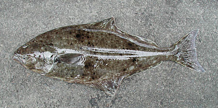
Pacific Halibut out of water, photo courtesy of Alaska Fish and Game
Five commercial fishermen from Alaska and Washington have been indicted by a federal grand jury, accused of conspiring to illegally harvest more than 10,000 pounds of halibut over a four-year period near Yakutat.
According to the U.S. Attorney’s Office, the fishermen, Jonathan Pavlik, 43, of Yakutat; Vincent Jacobson, 51, of Yakutat; Kyle Dierick, 36, of Yakutat; Michael Babic, 42, of Cordova; and Timothy Ross, 58, of Washington, each face federal charges under the Lacey Act, a law that prohibits illegal wildlife trafficking.
Prosecutors say the five men, all experienced commercial fishermen, took part in a conspiracy between 2019 and 2023 to violate halibut fishing rules tied to Individual Fishing Quotas, a system designed to sustainably manage halibut harvests in Alaskan waters.
The indictment alleges that Pavlik conspired separately with each of the other defendants to land halibut without being on board their vessels for the full duration of the fishing trips, a violation of federal regulations.
The indictment alleges that Pavlik, Jacobson, Dierick, Babic, and Ross intentionally falsely reported that the halibut caught was creditable to their respective Individual Fishing Quota (IFQ) permit balances, which is a permit any individual commercially fishing for halibut in the waters off Alaska is required to have. Pavlik and the three co-conspirators are responsible for over 10,700 pounds of illegally harvested halibut.
In a separate incident last fall, Pavlik allegedly sold over 9,600 pounds of illegally caught halibut that was fished aboard a vessel called the Bad Intentions and then transferred to another vessel, New Era, in an effort to conceal its origin before landing it for sale.
Pavlik faces 14 felony charges, including four counts of conspiracy, five counts of unlawful sale, and five counts of false labeling under the Lacey Act. Jacobson, Dierick, Babic, and Ross each face one count of conspiracy.
If convicted, each defendant could face up to five years in prison and fines of up to $250,000 per count. Court appearances are scheduled in the coming weeks before U.S. Magistrate Judge Matthew M. Scoble in Anchorage.
The investigation was led by NOAA Fisheries’ Office of Law Enforcement, Alaska Division, with support from the Alaska Wildlife Troopers. Assistant U.S. Attorneys Seth Brickey and Mac Caille Petursson are prosecuting the case.
An indictment is a formal accusation and not evidence of guilt. All defendants are presumed innocent unless proven otherwise in a court of law.
Linda Churchill carefully works on July 10 to finish painting the Bear up the mountain Totem
For the first time in 38 years, the Wrangell Native community has raised new totem poles in town, with four days of events planned Thursday through Sunday, July 17-20.
Unveiling the five new poles marks a significant revival of a centuries-old Tlingit tradition. The event honors the carvers and apprentices who transformed logs into cultural masterpieces, continuing a legacy nearly lost to time.
By the early 1900s, most of the town’s 30 to 40 totem poles had decayed or fallen, and the art of pole carving faded. The last totem pole raised in Wrangell was the Sun House Totem in 1987, carved by Steve Brown and Wayne Price, according to organizers of this week’s events.
Last week’s celebration symbolized a broader cultural resurgence that began with the 2013 rededication of Chief Shakes House and the 2015 completion of the WCA’s Carving Shed on Front Street, the organizers explained.
Each pole tells a story rooted in Tlingit and Haida traditions:
Bear Up The Mountain Pole: A Naanya.aayí X’atgu Hít narrative of survival during a great flood.
Gunakaadeit Pole: A Naanya.aayí X’atgu Naasí Hít tale of a man using a sea monster’s skin to feed his community.
Underwater Sea Bear Pole: A Sik’nax.ádi legend of a mythical good-luck creature.
Killer Whale Grave Marker: A Kayaashkeiditaan tribute to Shx’atoo, who died during the U.S. Army’s 1869 bombardment of the Native village at Wrangell.
Kadashan Pole: A replica of a 1940 pole, originally gifted by Haida relatives to honor intermarriage with Tlingit women in the 1830s.
Master carvers and apprentices
Leading the project are master carvers:
Joe Young (Haida, Yahgw’laanaas clan), who learned from his grandfather Claude Morrison and carved the Bear Up The Mountain and Gunakaadeit poles.
Tommy Joseph (Tlingit, Kaagwaantaan clan), a renowned woodcarver behind the Underwater Sea Bear Pole.
TJ Young (Haida, Yahgw’láanaas clan), lead carver for the Kadashan pole.
Apprentice carvers, including Mike Hoyt, Tony Harding, Linda Churchill and Susie Beebee, also contributed, ensuring the tradition’s future.
“What an incredible experience to witness the community, literally pulling together to stand Kadashan pole in Totem Park.” Tlingit &Haida said in a Facebook post.
“This is more than art – it’s healing,” said Joe Young. “We’re reclaiming our history.”
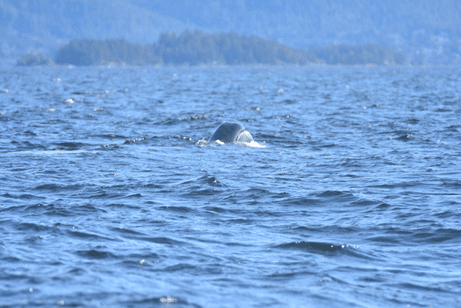
First sighting of subadult bowhead whale on March 27, 2024 at 11:45 am in Sitka Sound, Alaska, USA (57.06N, 135.53W). Credit: Ellen Chenoweth from the vessel Pioneer. NOAA Fisheries MMPA/ESA Permit No. 24378.
NOTN- Scientists in Sitka Sound observed a Bowhead whale, a first for Southeast Alaska, and only the second documented sighting in the eastern North Pacific.
Bowhead whales are one of the few whale species that reside almost exclusively in Arctic and subarctic waters experiencing seasonal sea ice coverage,.
Of all large whales, the bowhead is the most adapted to life in icy water. Adaptations to this environment include an insulating layer of blubber that can be up to 1.6 feet thick.
according to a scientific paper released by NOAA, the crew was using a 25-foot motorboat in Sitka Sound to photograph and identify humpback whales that had been observed bubble-net feeding in the area. Humpback whales are often present in large numbers in Sitka Sound in March, feeding on pre-spawn herring.
They also spotted gray whales, likely feeding on herring eggs near shore. After identifying several humpback whales in smaller groups, the crew was heading back to Sitka when they spotted another whale.
The vessel slowed to photograph this whale, but it didn’t appear to be a humpback. The whale was small, visible only by its head and jaw, which had a distinct arch. The crew took two photos before the whale submerged.
according to NOAA, the whale, identified by experts through photographs, exhibited unusual behavior. It was only observed with its head and jaw visible as it surfaced to breathe. Over the next month, additional sightings of the whale were reported. No feeding or social behaviors were noted, and on only one occasion was the back—which lacked a dorsal fin—visible.
“This sighting is important because it is a first for a pretty big region,” said Ellen Chenoweth, lead author on the study from the University of Alaska Fairbanks. “This is the first documented sighting of a bowhead whale in Southeast Alaska. It’s not the furthest south they have been seen, but it’s very notable because of how far it is from its typical range. It raises a lot of questions about what was going on with this animal that we can’t answer.”
NOAA researchers say this rare visit may be linked to ecosystem shifts like sea ice loss, which could push more Arctic species farther south.
“We know of only two previous observations of bowhead whales in the North Pacific,” said Kim Shelden. “In 1969, a subadult male bowhead whale was captured and died in Osaka Bay, Japan. In 2016, a young bowhead whale was photographed skim feeding near British Columbia, Canada. This specific bowhead whale sighting in March 2024 may be an indicator of rapid changes occurring in the Arctic,” said Shelden.