This satellite image provided by NASA Earth Observatory shows the retreat of Alsek Glacier in Glacier Bay National Park and Preserve in Alaska, as it loses contact with a land mass known as Prow Knob, center right, revealing an island, Aug. 6, 2025. (NASA Earth Observatory via AP)
AP- A retreating glacier revealed a new island in Alaska this summer, as lake water filled in to surround a land mass once hugged by ice.
Mauri S. Pelto, a glaciologist at Nichols College in Massachusetts, had anticipated for some time that the Alsek Glacier in southeast Alaska’s Glacier Bay National Park and Preserve would detach from the land mass referred to as Prow Knob. As the glacier has retreated, it has eroded a basin now filled by Alsek Lake, which is fed by the nearby Alsek River, glacier melt and icebergs, he said.
Pelto for years has used satellite imagery as part of his work chronicling changes in glaciers, and he had been checking images of the area at least once a month as he watched for the separation to occur, he said. It appears to have happened sometime between late July and early August.
Glacier Bay has over 1,000 glaciers, according to the park. While many glaciers in Alaska are retreating, not many new islands of size are revealed by their retreat, Pelto said. Prow Knob is roughly 2 square miles (5 square kilometers), and its highest point is just over 1,000 feet (304.8 meters), he said.
Imagery from the early 1980s, shared by NASA Earth Observatory, shows the Alsek Glacier largely surrounding Prow Knob, with Alsek Lake on one side. The glacier at that time shared a connection with Grand Plateau Glacier, the images show.
Over time, the lake has expanded as the glaciers have retreated. Alsek Lake is one of three lakes next to glaciers in the region that has seen marked growth since the 1980s, Pelto said.
NOTN- Officials issued a flood warning today for the Mendenhall Lake and River after gauges showed that Suicide basin had begun releasing water.
The National Weather Service said flooding is imminent or already occurring near the glacier visitor center, Mendenhall Campground, Skaters Cabin Road, View Drive and possibly downstream of the Back Loop bridge. The warning remains in effect until around 8:00 am to 12:00 pm tomorrow.
Officials from the National Weather Service in Juneau said in an interview that the flood is expected to crest at around 11.5 to 11.9 feet, it’s not expected to be on the same scale as the flood that struck in August.
“This one’s going to come out significantly lower,” said Jeff Garmon with National Weather Service Juneau, “That doesn’t mean there won’t be impacts, but it’s not the same situation we were facing in August.”
Garmon advised residents to monitor updates from the City and Borough of Juneau for any evacuation guidance but said no immediate evacuations were being recommended.
He added that forecasters are continuing to refine projections as new data becomes available.
“We’re working with CBJ right now. We’ll have more information going out on social media.” He said.
This story has been updated as of Tuesday morning to reflect the National Weather Service had warned water from Suicide Basin could crest near 12 feet overnight, but the river actually peaked lower about 9.6 feet around 7:30 p.m. Monday, just shy of the moderate flood stage.
The Flood Warning for the Mendenhall Lake and River has since been cancelled. Levels have been steadily dropping and were already below minor flood stage by 10 p.m.
NOTN- An Italian man is missing after falling into a rushing stream on Mendenhall Glacier and being swept into a narrow opening in the ice, authorities said.
Alaska Wildlife Troopers said they received a report around 1:45 p.m. Tuesday that the man had slipped into the water and disappeared into a roughly 2-foot-wide vertical hole. The two people traveling with him told officials they could no longer see him once he fell inside.
Juneau Mountain Rescue deployed a technical ice rescue team, which determined the hole was filled with fast-moving water and too dangerous to search.
Authorities said efforts are ongoing to notify the man’s next of kin in Italy.
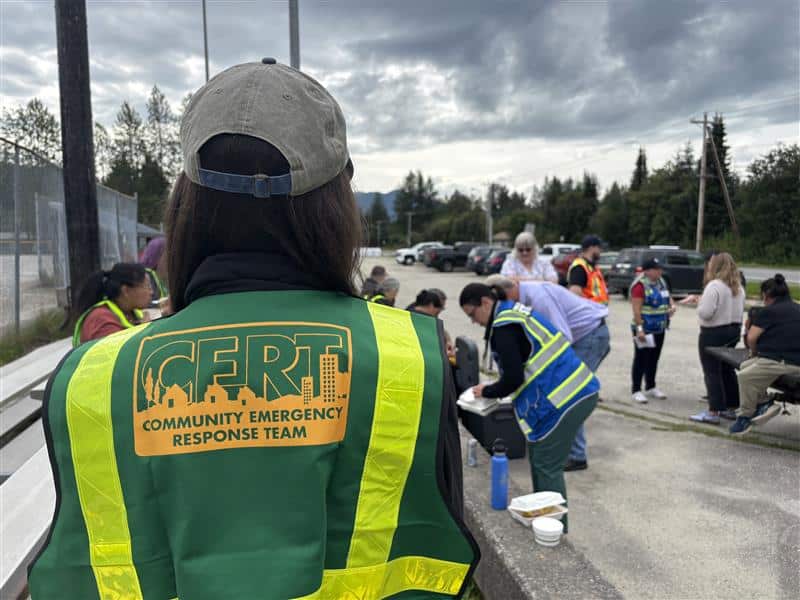
NOTN- Teams of organizations and volunteers from across Juneau—Tlingit & Haida, CBJ, Alaska Department of Environmental Conservation, USCG Sector Southeast Alaska, Community Emergency Response Team volunteers, Team Rubicon, American Red Cross, United Way of Southeast Alaska, and University of Alaska Southeast—worked together in the field to support impacted residents, identify any spills or safety hazards and to get a better understanding of the damage from this year’s flood. The teams assessed over 700 homes in the flood inundation area.
As a result, CBJ reports that overall damage levels are far below those of 2024. However, some homes and properties have suffered flood damage—especially to basements and crawlspaces—and will now begin recovery.
Crews will begin the first round of flood debris collection in Juneau on Monday, Aug. 17, starting at 8 a.m. in impacted neighborhoods on View Drive, Marion Drive, Meander Way and Meadow Lane.
Residents are asked to move debris to the right of way and sort it into three piles: large appliances such as refrigerators, freezers and lawn mowers; household hazardous waste including chemicals, pesticides, fuel, propane tanks and electronic waste; and all other debris, including construction materials and insulation.
Please be aware that CBJ, Tlingit & Haida and United Way are not accepting sandbags for disposal. Residents are strongly encouraged to keep and store sandbags for future outbursts for years to come.
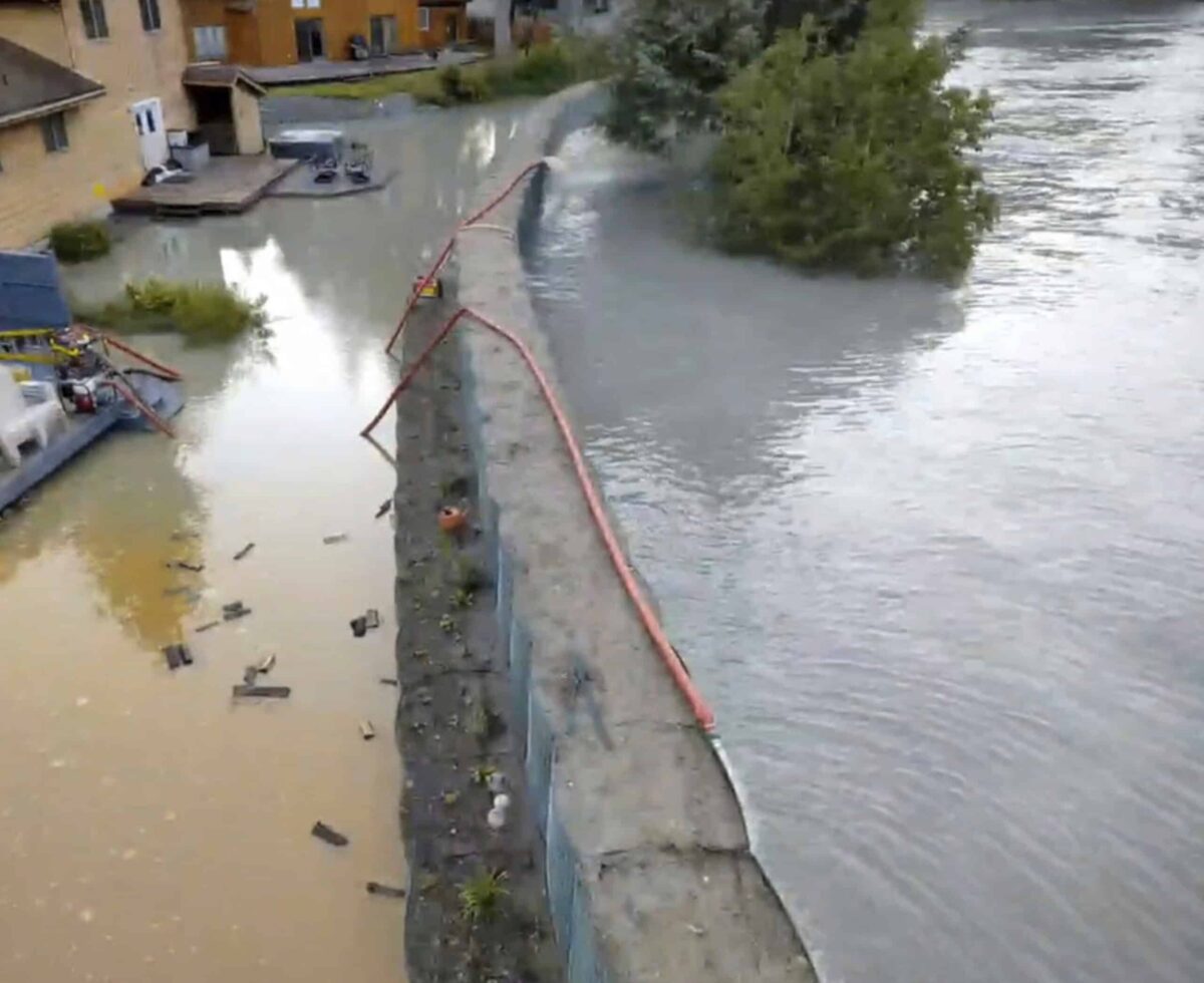
This drone image provided by the City and Borough of Juneau shows flooding from a release of water and snowmelt at Mendenhall Glacier covered some roads and threatened homes along the Mendenhall River in Juneau, Alaska on Wednesday, Aug. 13, 2025. (City and Borough of Juneau via AP)
This drone image provided by the City and Borough of Juneau shows flooding from a release of water and snowmelt at Mendenhall Glacier covered some roads and threatened homes along the Mendenhall River in Juneau, Alaska on Wednesday, Aug. 13, 2025. (City and Borough of Juneau via AP)
AP- New sandbag-style barriers installed along a river in Alaska’s capital city held back record levels of flooding and prevented widespread damage after an ice dam at the nearby Mendenhall Glacier released a massive amount of rainwater and snowmelt downstream, officials said Wednesday.
Water pooled on several streets and in some yards in Juneau after the Mendenhall River crested earlier in the day, and high water was expected to persist for hours. But many residents in the flood zone evacuated ahead of peak water levels, and there were no damage reports similar to the last two years, when flooding was rampant and some homes washed away.
The barriers “really have protected our community,” Juneau City Manager Katie Koester told a news conference. “If it weren’t for them, we would have hundreds and hundreds of flooded homes.”
The Mendenhall Glacier is about 12 miles (19 kilometers) from Juneau, home to 30,000 people in southeast Alaska, and is a popular tourist attraction due to its proximity and easy access on walking trails. Homes on the city’s outskirts are within miles of Mendenhall Lake, which sits below the glacier, and many front the Mendenhall River, into which the glacial outburst flowed.
Juneau, which is accessible only by boat and plane, is 570 miles (917 kilometers) southeast of Anchorage, Alaska’s largest city. The flooding won’t impact Friday’s summit in Anchorage between President Donald Trump and Russian President Vladimir Putin.
Basin flooding is a yearly worry
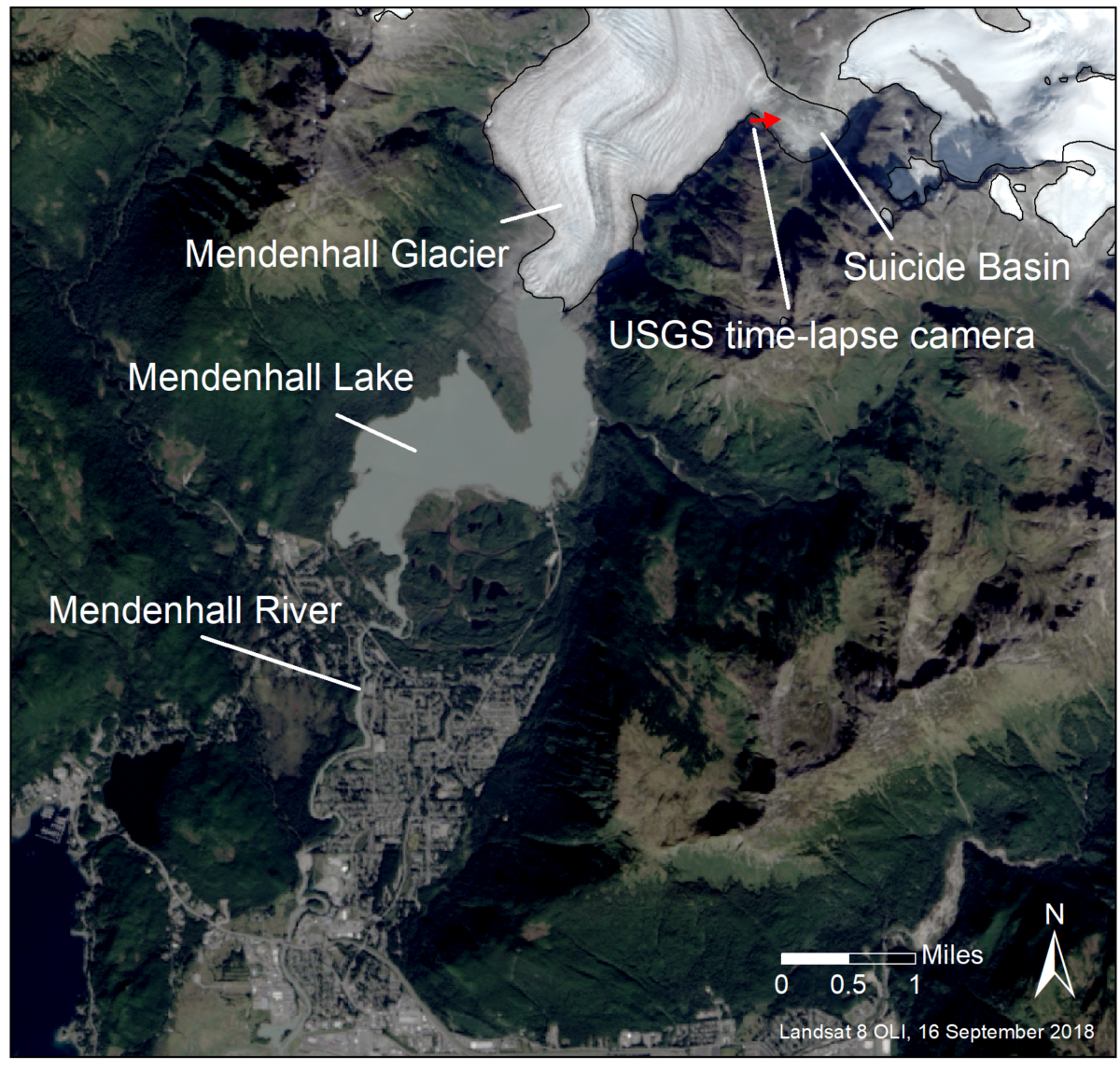
Flooding from the basin has become an annual concern since 2011 and has gotten worse in recent years. It happens because a smaller glacier near Mendenhall Glacier retreated — a casualty of the warming climate — and left a basin that fills with rainwater and snowmelt each spring and summer, dammed by the glacier.
When the water builds up enough pressure, it forces its way under or around the ice dam, enters Mendenhall Lake, and flows down the Mendenhall River.
The city saw successive years of record flooding in 2023 and 2024, with flooding extending farther into the Mendenhall Valley.
A large outburst can release some 15 billion gallons of water, according to the University of Alaska Southeast and Alaska Climate Adaptation Science Center. That’s the equivalent of nearly 23,000 Olympic-size swimming pools. During last year’s flood, the flow rate in the rushing Mendenhall River was about half that of Niagara Falls, the researchers say.
Barriers are installed
City officials responded to concerns from property owners this year by working with state, federal and tribal entities to install a temporary levee along roughly 2.5 miles (4 kilometers) of riverbank in an attempt to guard against widespread flooding. The 10,000 “Hesco” barriers are essentially giant, reinforced sandbags intended to protect more than 460 properties, said emergency manager Ryan O’Shaughnessy.
But the measure was not without critics. Two homeowners have sued, complaining that the government was taking their property to erect the barriers without compensating them.
On Tuesday and Wednesday, some water seeped into yards through drains that had been installed under the barriers. In other spots, trees floating down the river struck and damaged the barriers, officials said.
The U.S. Army Corps of Engineers is at the start of what’s expected to be a yearslong process of studying conditions in the region and examining options for a more permanent solution, such as a levee. The timeline has angered some residents, who say it’s unreasonable.
Outburst floods are expected to continue as long as the Mendenhall Glacier acts as an ice dam to seal off the basin, which could span another 25 to 60 years, according to the university and science center researchers.
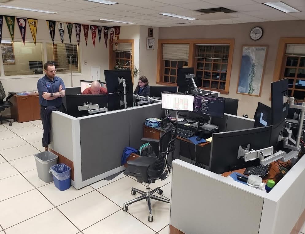
The National Weather Service operations, photo courtesy of the National Weather Service.
NOTN- As of this morning, the Mendenhall River remains in major flood stage due to the ongoing release from Suicide Basin and three days of heavy rain. As of 5 a.m., the river was at 15.78 feet and rising.
Forecasters expect it to crest between 16.25 and 16.75 feet late this morning, with the highest likelihood near 16.75 feet around 8 a.m. The river is expected to drop below flood stage by Tomorrow.
According to the City and Borough of Juneau, HESCO barriers have not been breached, officials reported ponding water on Meander Way and Marion Drive, which is not a breach of the barriers themselves.
According to CBJ this is water seepage at the barriers and crews have installed water pumps.
City and staff continue to monitor conditions and will provide updates as things change.
AP- Residents in some parts of Juneau prepared to evacuate ahead of what could be a record surge of flooding as rainwater and snowmelt in a huge basin dammed by Alaska’s Mendenhall Glacier started to flow downstream toward the capital city.
Officials in recent days have been warning people in the flood zone to be ready to evacuate. On Tuesday morning they confirmed water had started escaping the ice dam, with flooding expected late Tuesday and on Wednesday. They advised people in the city’s flood zone to leave.
The Mendenhall Glacier is about 12 miles (19 kilometers) from Juneau and is a popular tourist attraction due to its proximity to Alaska’s capital city and easy access on walking trails. Homes on the city’s outskirts are within miles of Mendenhall Lake, which sits below the glacier, and many front the Mendenhall River.
The water that’s being released in the glacial outburst is flowing into the river, putting homes that are closest to the river at risk. The National Weather Service said it expected flooding to peak at 4 p.m. local time Wednesday.
“This will be a new record, based on all of the information that we have,” Nicole Ferrin, a weather service meteorologist, told a news conference Tuesday.
Flooding from the basin has become an annual concern, and in recent years has swept away houses and swamped hundreds of homes. Government agencies installed temporary barriers this year in hopes of protecting several hundred homes in the inundation area from widespread damage.
The thinning, retreating glacier in southeast Alaska acts as a dam for Suicide Basin, which fills each spring and summer with rainwater and snowmelt. The basin itself was left behind when a smaller glacier nearby retreated.
When the water in the basin builds up enough pressure, it forces its way under or around the ice dam, entering Mendenhall Lake and eventually the Mendenhall River.
Before the basin reached the limit of its capacity and began overtopping, the water level was rising rapidly — as much as 4 feet (1.22 meters) per day during especially sunny or rainy days, according to the National Weather Service.
The threat of so-called glacier outburst flooding has troubled parts of Juneau since 2011. In some years, there has been limited flooding of streets or properties near the lake or river.
But 2023 and 2024 marked successive years of record flooding, with the river last August cresting at 15.99 feet (4.9 meters), about 1 foot (0.3 meters) over the prior record set a year earlier, and flooding extending farther into the Mendenhall Valley. This year’s flooding was predicted to crest at between 16.3 and 16.8 feet (4.96 to 5.12 meters).
A large outburst can release some 15 billion gallons of water, according to the University of Alaska Southeast and Alaska Climate Adaptation Science Center. That’s the equivalent of nearly 23,000 Olympic-size swimming pools. During last year’s flood, the flow rate in the rushing Mendenhall River was about half that of Niagara Falls, the researchers say.
City officials responded to concerns from property owners this year by working with state, federal and tribal entities to install a temporary levee along roughly 2.5 miles of riverbank in an attempt to guard against widespread flooding. The installation of about 10,000, four-foot (1.2-meter) tall barriers is intended to protect more than 460 properties from flood levels similar to last year, said Nate Rumsey, deputy director with the city’s engineering and public works department.
The U.S. Army Corps of Engineers is at the start of what’s expected to be a yearslong process of studying conditions in the region and examining options for a more permanent solution. The timeline has angered some residents, who say it’s unreasonable.
Outburst floods are expected to continue as long as the Mendenhall Glacier acts as an ice dam to seal off the basin, which could span another 25 to 60 years, according to the university and science center researchers.
NOTN-Juneau’s Unified Command is preparing residents for the anticipated , Suicide Basin release that could cause flooding along the Mendenhall River.
Once water begins to spill from the basin, the National Weather Service will issue a flood warning, and the Unified Command will send evacuation advisories through multiple channels.
City and school district officials are preparing for possible closures affecting all Juneau schools, even though only three are located along the river. The district said closures could last as long as the evacuation advisory remains in effect.
Juneau Mayor Beth Weldon says they are moving through the evacuation as if the HESCO Barriers – which are placed along Mendenhall river – aren’t there.
“We’re assuming that they will work.” Said Mayor Weldon “We did this all with the Army Corps of Engineers, they were quite excited about them working, and we’re hopeful that things will be much better than last year. But again, it’s still a flood area, so we are asking people evacuate.”
If the advisory is issued before the school day begins, classes will be canceled. If flooding is expected during the day, at-risk schools may release students early or relocate them to safe sites for parent reunification. Guardians and emergency contacts must provide photo ID to pick up students.
In some cases, bus riders who live in the evacuation area but attend schools elsewhere may be taken to a central pickup point outside the flood zone rather than back into affected neighborhoods.
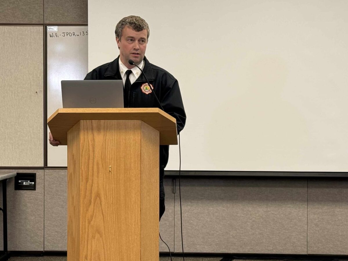
Sam Russell, Assistant Chief of Administration at CCFR, talks through flood mitigation efforts at August 11 meeting
NOTN- Unified Command is ramping up flood preparations in Juneau, issuing evacuation advisories for at-risk neighborhoods, completing key flood barriers, and closing trails and parks as water levels continue to rise.
in a meeting at the Juneau Police Department, the multi-agency response involving the City and Borough of Juneau, Central Council of the Tlingit & Haida, and state and federal partners told media they were focused on safety, protecting infrastructure, and providing timely public information.
Officials moved the response from “ready” to “set” phase this week, meaning residents in potential inundation zones should be prepared to leave if conditions worsen.
Responders urged residents to have a go-bag ready, review evacuation plans, and sign up for alerts.
Teams are distributing door hangers with QR codes linking to flood maps and emergency updates, and a hotline staffed by responders went live.
The Red Cross has opened an evacuation shelter at Floyd Dryden Gymnasium.
Construction crews have completed Phases 1 and 1A of the HESCO barrier system along the Mendenhall River, but Phase 1B remains on hold due to the lack of property agreements with private landowners.
Closures are also in effect for the pedestrian bridge at Diamond Park, parts of the Montana Creek Trail system, the Brotherhood Bridge Trail, and the Nugget Falls Trail at the glacier. Additional trail closures will be triggered as the lake rises, including the paved Egan Drive path near Brotherhood Bridge once water reaches 10 feet.
Alaska Electric Light & Power plans targeted power cuts in areas that flood, including specific lift stations. Neighborhoods protected by HESCO barriers will not lose power unless inundation occurs. Water and sewer service is not expected to be disrupted.
School officials are coordinating closely with Unified Command and may close schools, release students early, or cancel classes depending on flood warnings from the National Weather Service.
Real-time modeling and flood forecasts are available at JuneauFlood.com.
NOTN- Suicide Basin has begun overtopping and could release floodwaters within one to six days, officials say.
The City and Borough of Juneau, the Central Council of the Tlingit & Haida, and local weather agencies are monitoring the basin closely and will issue an alert when the release begins.
Residents in potential inundation zones are urged to finish last-minute preparations, confirm evacuation plans, and assemble go-bags.
Forecast data is available at JuneauFlood.com, and residents can sign up for emergency alerts by texting CBJ to 38276.