NOTN- After another glacial outburst flood on the Mendenhall River, Juneau officials are turning their focus to how the city will pay for long‑term protection of flood‑prone neighborhoods.
City Manager Katie Koester told the Assembly that the U.S. Army Corps of Engineers is moving ahead with an industry led solution, which could move on a faster time-line than one directed by the Army Corp.
The project would be designed to Suicide basin below 1,100 feet and hold future events to minor flood levels.
While final designs and costs are still unknown, Koester said the overall price tag could reach hundreds of millions of dollars, leaving Juneau responsible for an estimated $40 million to $100 million depending on the federal cost share, 10 to 25 percent.
According to Koester, after speaking with Alaska Senator Dan Sullivan’s office, Alaska’s congressional delegation is now working to change federal law so Juneau can receive the same 90-10 cost share available for Army Corps projects on tribal lands under the conventional process.
“I do think our state having some participation in the funding of an enduring solution is important… we have local government, federal government, tribal government, and state government all working together.” Koester said.
The city has already spent nearly $10 million in local funds on HESCO barriers and related work over recent flood seasons, and staff time has been pulled away from other core capital projects such as water, wastewater and facilities maintenance. Koester said engineering, public works and emergency management have been “absorbing” much of the response workload, and warned that can’t continue indefinitely without tradeoffs or added staff.
“We have spent a little under $10 million of CBJ taxpayer money, and that is thanks to grants and partnerships. Army Corps has spent significantly more more than that.” Koester said, “There will be maintenance responsibilities that we’ll be in charge of, including inspection, unfortunately protecting against vandalism. We’ve already seen the barrier slashed. We’ve already seen warming fires being built right up against the barriers.”
Assembly members are weighing a mix of options, including a special service area tax for roughly 1,800 homes in and around the flood zone currently protected by HESCOs, bonds backed by area‑wide taxpayers, and potential contributions from the state. A one‑mill levy in a HESCO service area would likely raise less than $1 million a year, meaning the general fund would still play a major role.
The Assembly is also debating whether to compensate homeowners who host HESCO barriers on their land through temporary easements, and whether to limit new development in the flood corridor while it asks voters to help finance a permanent solution. A small Assembly “strike team” will work with staff to refine funding options before they return to the full body for public debate.
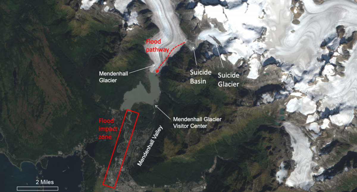
Mendenhall overview from the National Weather Service
NOTN- The city of Juneau has entered a heightened state of readiness after officials confirmed just this morning that Suicide Basin is full, meaning the anticipated Glacial Lake Outburst Flood in the Capitol city could happen at any time.
“We call this the set phase, where people should be prepared to evacuate.” Said Mayor Beth Weldon, “But it could still be days, if any. We’re all getting used to this. It could be within 24 hours, or even as much as five or six days until the basin releases.”
Weldon said the timing of any potential outburst flood remains uncertain. The City is in the “Set” phase of it’s ‘Ready, Set, Go’ framework, which means residents affected by the GLOF should stay vigilant and continue to check in with emergency officials, have a go bag packed and be ready to activate a plan of safety.
According to the National Weather Service, in the past it has taken up to 6 days for the main event to start after the basin is full.
City officials urged residents to closely follow evacuation notices and stay away from flood control structures, particularly the Hesco barriers along vulnerable stretches of riverbank.
“Please do not climb up on the Hesco barriers,” Weldon said. “If they fail, it’s going to be catastrophic, and they could fail in a moment’s notice. You will not have time to run or move.”
if you have any questions, you can call the flood hotline at 907-500-0890 for information and updates.
“Everybody, try and be safe, and please abide by the evacuation notice,” Weldon said. “Again, everybody stay safe.”
NOTN- As Suicide Basin nears capacity, the City and Borough of Juneau is urging residents in the flood evacuation zone to finalize their emergency plans.
In an interview with CBJ Emergency Programs Manager Ryan O’Shaughnessy, he said residents are encouraged to know where they’ll go if an evacuation is ordered.
“The basin is is almost full, once the basin becomes full and gets to 1350 ft, folks can expect to get an alert on their phones.” O’Shaughnessy said, “That’ll that loud, sort of jarring alert, a sort of siren that comes out of your phone for just a minute. And that’ll let people know that the basin has become full. And in our Ready, Set, Go framework, we’ve moved from Ready into Set. That means it’s time for folks to have a bag packed, it’s time to make sure your phone is charged, there’s gas in the car, and that you’re ready to go when the basin begins to release.”
We’ve put together the CBJ approved evacuation routes, take note of what’s nearest to you if you are in the evacuation zone.
Residents north of Division Street, please travel north on Riverside Drive, toward Mendenhall (Back) Loop Road and out of the inundation area.
Residents south of Division Street, travel south on Riverside Drive, turn left on Stephen Richards Memorial Drive, towards Mendenhall Loop Road.
On Rivercourt Way, travel south on Riverside Drive, toward Egan Drive
On the west side of the Mendenhall River, travel west on Mendenhall (Back) Loop Road toward Auke Bay (avoid Back Loop Bridge).
West of Brotherhood Bridge, travel west on Glacier Highway toward Auke Bay
An emergency shelter will be available at Floyd Dryden Middle School, and limited space is available there for pets. Juneau Animal Rescue can also help coordinate temporary pet sheltering.
People in the evacuation zone are also being asked to register their vehicles in advance if they plan to use the city’s temporary flood parking areas, which are located at St. Brendan’s Episcopal Church 4207 Mendenhall Loop Road, Shepherd of the Valley Lutheran Church 8198 Keegan Street, Christ Lutheran Church 10300 Glacier Hwy, Juneau Christian Center 8001 Glacier Hwy.
“We’re optimistic, and we have a tremendous amount of confidence in the HESCO barriers, but it’s not something to bet your life on. That’s why we’re really encouraging folks who live in the hazard area to evacuate and go ahead and heed that evacuation advisory when that’s issued.” O’Shaughnessy said.
Officials recommend preparing homes now by moving valuables, as well as items such as oils, paints and cleaning products, into secure waterproof containers at higher elevations.
Residents should also have a go-bag packed and ready in case an evacuation order is issued.
Officials remind residents not to drive or walk through floodwaters and to wait for an official all-clear before returning home after the event. The City and Borough of Juneau has also activated a flood information hotline for non-emergency questions. The hotline currently operates weekdays, with expanded weekend and around-the-clock hours planned once the basin fills and, if necessary, when a flood begins. United Way of Southeast Alaska is also coordinating volunteers and assistance for residents who may need help before or after the flood.
Flood waters are rising at a rate of about 3 feet per day but more information about flood preparedness is available through the City and Borough of Juneau’s flood readiness resources, the National Weather Service or by calling the flood hotline.
CBJ- The City and Borough of Juneau Flood Information Hotline is now available during weekdays. Residents can call the hotline with non-emergency questions and concerns related to the 2026 glacial lake outburst flood. The hotline is available at 907-500-0890 on Mondays through Fridays from 9 a.m. to 4 p.m.
Once Suicide Basin is filled, the hotline will extend operating hours to include Saturdays and Sundays from 9 a.m. to 4 p.m. Once release has begun – and a wireless emergency alert text message goes out – the hotline will move to 24/7 operations through the event.
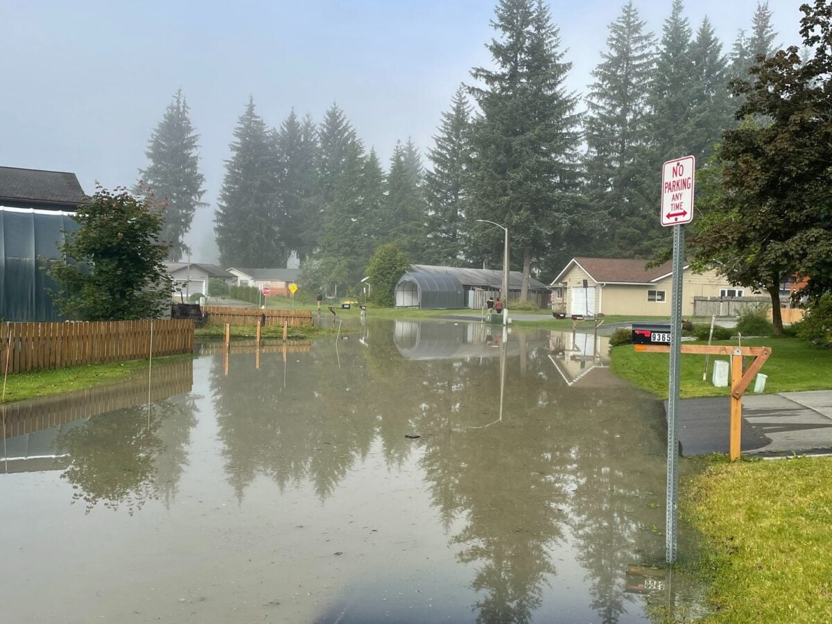
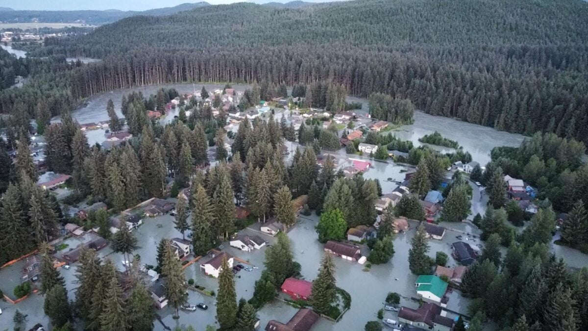
This drone image provided by the City and Borough of Juneau shows flooding from a release of water and snowmelt at Mendenhall Glacier covered some roads and threatened homes along the Mendenhall River in Juneau, Alaska on Wednesday, Aug. 13, 2025. (City and Borough of Juneau via AP)
This drone image provided by the City and Borough of Juneau shows flooding from a release of water and snowmelt at Mendenhall Glacier covered some roads and threatened homes along the Mendenhall River in Juneau, Alaska on Wednesday, Aug. 13, 2025. (City and Borough of Juneau via AP)
CBJ- The City and Borough of Juneau (CBJ) Assembly Committee of the Whole (COW) Worksession scheduled for Monday, July 20 at the Andrew Hope Building has been cancelled for both topical and timing reasons. CBJ will move the planned agenda topics to a future COW worksession after the 2026 glacial lake outburst flood (GLOF).
The Special COW meeting was originally scheduled to provide updates and allow for assembly discussion on topics related to the annual threat of glacial lake outburst flooding events. The meeting included an update from the U.S. Army Corps of Engineers, a discussion of flood protection costs and potential funding mechanisms, and flood preparedness updates from the CBJ Emergency Management and Tlingit & Haida Public Safety offices.
“With a 2026 GLOF just days to weeks away, all three of our agencies (USACE, Tlingit & Haida and CBJ) are talking with residents daily about mitigation, preparation and how they can stay safe,” shared City Manager, Katie Koester. “We understand that our flood vulnerable neighbors are dedicating their focus and time to the flood just ahead of us, and realized there was nothing in the planned meeting agenda that couldn’t wait until after the waters have receded and residents have more capacity to tune in and share their input.”
The July 20 COW was scheduled to take place in the Council Chambers of the Central Council of the Tlingit & Haida Indian Tribes of Alaska in the Andrew Hope Building.
“We are honored that President Peterson and the Central Council invited the Assembly to conduct our meeting in their Executive Council Chambers showcasing the strong spirit of collaboration between our two governments,” said CBJ Deputy Mayor Greg Smith. “We are already looking for the next opportunity to meet and discuss these critical issues that impact Juneau’s residents, including tribal citizens in their Chambers.”
Updates regarding GLOF mitigation solutions and flood preparedness are regularly shared on the CBJ, USACE and Tlingit & Haida social media pages. Flood planning resources, including evacuation maps, are available at bit.ly/juneaufloodready. CBJ is also hosting sandbag distribution events tomorrow (July 18) and on all subsequent Saturdays until the 2026 GLOF.
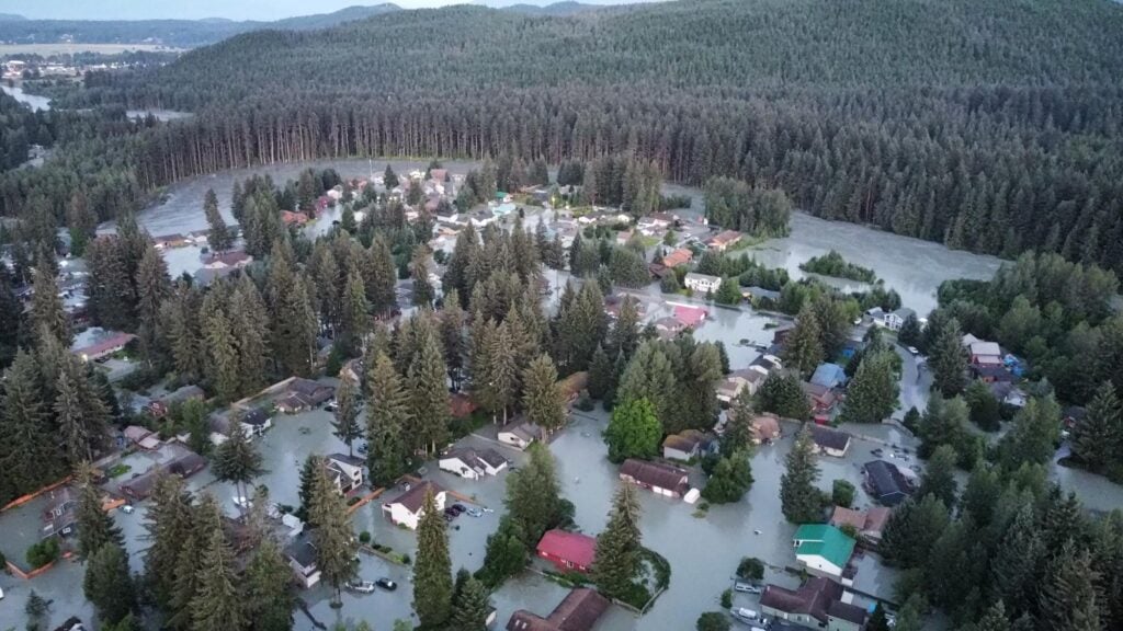
This drone image provided by the City and Borough of Juneau shows flooding from a release of water and snowmelt at Mendenhall Glacier covered some roads and threatened homes along the Mendenhall River in Juneau, Alaska on Wednesday, Aug. 13, 2025. (City and Borough of Juneau via AP)
This drone image provided by the City and Borough of Juneau shows flooding from a release of water and snowmelt at Mendenhall Glacier covered some roads and threatened homes along the Mendenhall River in Juneau, Alaska on Wednesday, Aug. 13, 2025. (City and Borough of Juneau via AP)
NOTN- City leaders are asking View Drive homeowners, the area hit hardest by glacial lake outburst flooding, to weigh in on whether they want to pursue a voluntary federal buyout program.
The City and Borough of Juneau is gauging interest in a potential buyout through the U.S. Department of Agriculture’s Natural Resources Conservation Service Emergency Watershed Protection program, (NRCS) which helps communities recover from natural disasters by purchasing at-risk properties and restoring the land.
Under the program, eligible properties would be acquired at fair market value, followed by environmental review, demolition and site restoration. NRCS would cover 75% of total project costs, but Juneau would be responsible for the remaining 25%.
The non-federal match is estimated at about $6 million if all 18 eligible structures on View Drive take part.
City Manager Katie Koester said the city wants to know whether homeowners would be willing to help assemble that non- federal match, either through their own resources or with help from nonprofits and other non-federal sources, asking owners through an informal ballot, to indicate whether they would be willing to participate if that cost share were required, though responses are not binding.
“The Assembly really hasn’t received any official communication from View Drive residents on whether or not they are even interested in participating in the program,” Koester said. “The first important step is sending them an informal ballot to gauge actual interest in participating.”
View Drive is considered one of the neighborhoods most vulnerable to annual flooding caused by glacial lake outburst floods, as it sits just outside the reach of the HESCO barriers.
Juneau officials have discussed buyouts as one possible option for residents, particularly as flooding frequency and severity increase, though Koester stressed that whether or not the city goes through with the buy-out program, officials are still committed to an enduring solution.
“I just want to make sure that the public knows that it is the number one priority for the City of Juneau, to find a permanent solution to the flooding, not just for View Drive, but for the entire valley.” She said.
Koester said the Assembly is seeking to understand whether enough property owners would participate to justify moving forward.
Participation in the program would be entirely voluntary, and Koester emphasized that not every property owner would need to opt in for the project to move forward.
“‘It’s totally feasible that four people want to participate, and we move forward, and the rest of the neighborhood does not participate.”
Property owners have until Feb. 16 to return their ballots to the city’s engineering division, those results from residents are expected to be presented at the assembly’s Committee of the Whole meeting on Feb. 23.
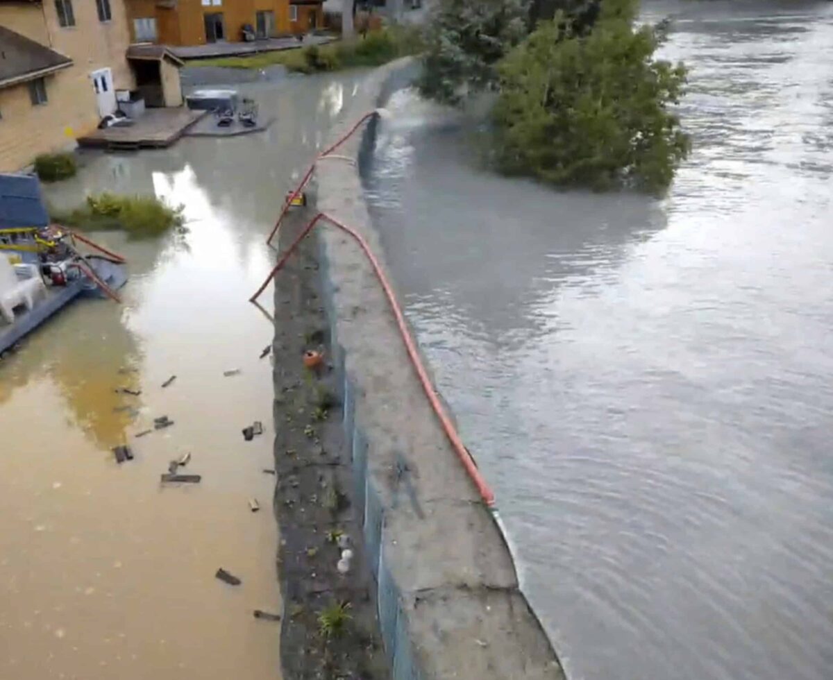
This drone image provided by the City and Borough of Juneau shows flooding from a release of water and snowmelt at Mendenhall Glacier covered some roads and threatened homes along the Mendenhall River in Juneau, Alaska on Wednesday, Aug. 13, 2025. (City and Borough of Juneau via AP)
This drone image provided by the City and Borough of Juneau shows flooding from a release of water and snowmelt at Mendenhall Glacier covered some roads and threatened homes along the Mendenhall River in Juneau, Alaska on Wednesday, Aug. 13, 2025. (City and Borough of Juneau via AP)
NOTN- City officials in Juneau say flood protection measures largely held during this month’s Suicide Basin release, but the risk of another release later this year remains.
Emergency Programs Manager Ryan O’Shaughnessy said five of the most severely damaged homes were on View Drive.
The barriers prevented widespread destruction but still experienced seepage and minor flooding in some areas.
“Six homes did have that major damage classification, And what that means is that water entered the living space and was generally above the height of a standard electrical outlet.” Said O’Shaughnessy, “At this time, the best professional judgment of the CBJ Engineering and Public Works team does believe that the HESCO barriers are not a viable solution for View Drive, so we’re working to identify any other solutions we can.”
Officials say long-term options for View Drive could include state- or federally sponsored buyouts. Meanwhile, the city is focusing on assessing barrier performance, repairing damaged sections, and moving forward with “Phase Two” of the project, which would extend protection as far as Brotherhood Bridge and Meadow Lane.
“There’s a lot of questions about phase two, and we’re working really hard to answer those, but seeing the effectiveness of the HESCO barriers this year is a great indication and a good reminder that we’re not out of the woods yet,” O’Shaughnessy said.
Last year, Suicide Basin released again in October with a final flood stage of just under 11 feet, and officials warn the glacier-dammed lake is currently refilling at a steady rate of about three feet per day, O’Shaughnessy said. “It is entirely possible we could see another release this year, another great reminder that we have a lot of work to do as a community.”
The city issued evacuation notices to more than 1,000 homes ahead of the flood, which crested at 16.6 feet, the highest on record. O’Shaughnessy credited the unified response involving the City and Borough of Juneau, state agencies, tribal partners, and the U.S. Coast Guard with preventing loss of life.
The Mendenhall River reached its peak crest at 16.65 feet around 7:15 a.m. this morning, according to the National Weather Service.
Sean, a meteorologist with the National Weather Service, confirmed that water levels are expected to gradually recede throughout the day.
“We’ve determined that a crest occurred of around 16.65 feet, around 710, 7:15, this morning.” Said Sean, “From that point though, it will still take 15 to 45 minutes for areas further downstream to also observe this crest in river.”
No additional rainfall is forecast for Juneau through Friday, which should help stabilize river conditions.
“We will see water levels continue to drop, so through today and tomorrow, and even into Friday, we are not having any additional rainfall, so there should be no extra input into the basin.”
NOTN- Local officials are warning residents of imminent flooding, with the river crest now predicted to occur earlier than previously anticipated, potentially before noon tomorrow.
Sabrina Grubitz, Tlingit and Haida Public Safety Manager and incident commander for the 2025 flood response, announced this evening that the National Weather Service has moved up the flooding timeline by four to six hours. Flooding could begin as early as 8 AM.
“Tomorrow we are looking somewhere before noon, and certainly, if individuals have not evacuated the flood zone at this point in time, they’re highly encouraged to evacuate immediately and get out of out of that area.” Said Grubitz, “We could see flooding as as early as eight or so, so making sure that individuals are prepped and ready before they go to sleep tonight.”
The situation is developing rapidly, and officials stress the importance of taking immediate precautions to ensure personal safety.
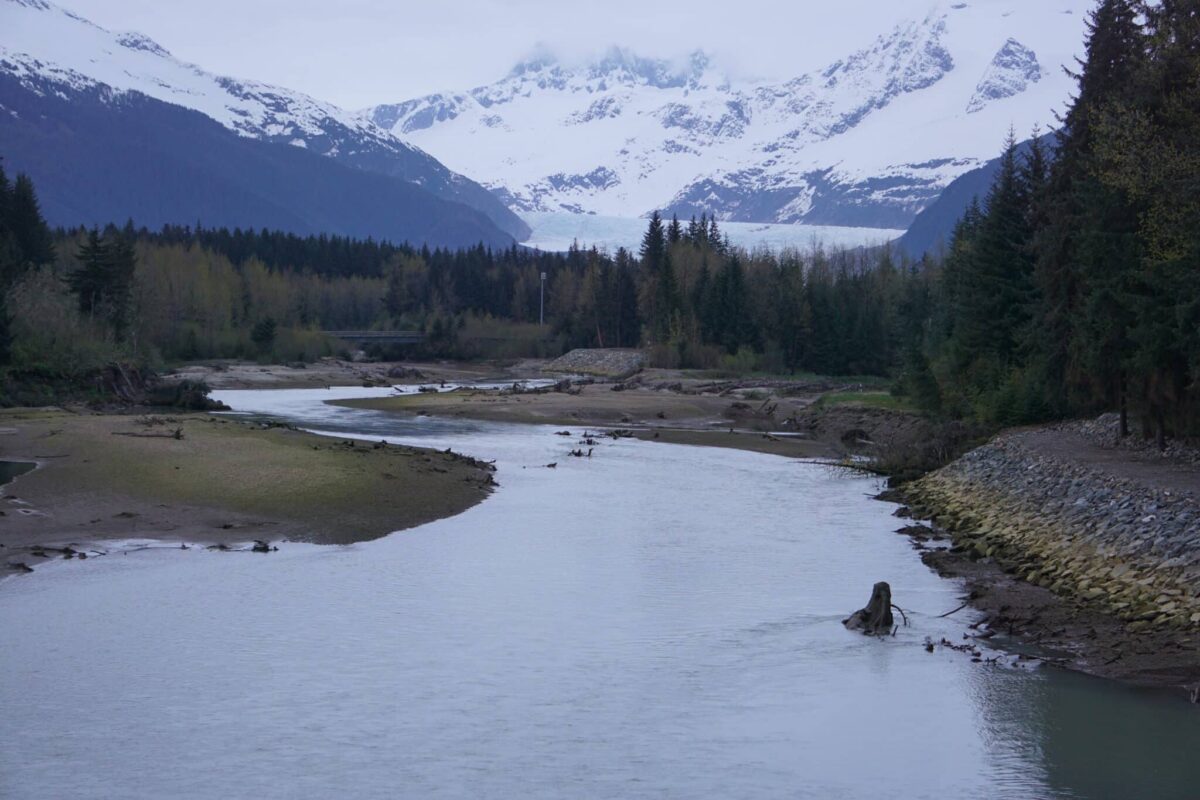
The Mendenhall River, which flows out of Mendenhall Glacier, is seen on May 14, 2025. (Photo by Yereth Rosen/Alaska Beacon)
When water from melting glacier inundated her Juneau neighborhood last August, Danielle Lindoff made a hasty escape through a front window in her living room, her two unhappy cats in tow. She climbed onto a boat mobilized by her husband, and as he steered, she held a flashlight to scout in the dark for submerged mailboxes that they might bump on their way to safety.
Danille Lindoff, a resident of Juneau’s Mendenhall Valley, points on March 13, 2025, to her front door to show the level that water reached during the record 2024 outburst flood from Mendenhall Glacier. (Photo by Yereth Rosen/Alaska Beacon) Danielle Lindoff, standing in front of her Mendenhall Valley house on March 13, 2025, shows how high water rose during the record glacial outburst flood of August 2024. On that night, as her husband steered the boat they used to escape, Lindoff held out a flashlight to look for submerged mailboxes so they could avoid bumping into them. (Photo by Yereth Rosen/Alaska Beacon)
Though the Mendenhall River flowing by their backyard had been swollen with floodwaters in past years – and though the Lindoffs had taken precautions last summer like sealing doorways and stacking sandbags – the Aug. 5-6, 2024, event was the biggest Mendenhall Glacier outburst flood ever measured. The water that rushed out of a breached glacial ice dam brought the river to a record crest of 15.99 feet, inundating about 290 homes and stunning much of the community.
A drone image shows widespread flooding in the Mendenhall Valley in Juneau on Aug. 6, 2024. The flood was from an outburst at Suicide Basin, part of the Mendenhall Glacier complex. A similar glacial outburst flood struck the same area in 2023. (Image courtesy of Rich Ross) The streamflow at Mendenhall Lake during two glacial outburst floods is shown. The previous record-high outburst flood, in 2023, is shown in blue. The new record flood, in2024, is shown in orange. (Graph provided by the National Oceanic and Atmospheric Administration, based on data from the U.S. Geological Survey)
“No one expected it to be this big,” Lindoff said months later in an interview at her freshly repaired and refurbished house.
The community is no longer likely to be caught by surprise.
“It’s probably likely that the floods could get larger in the future,” said Eran Hood, an environmental science professor and glacier specialist at the University of Alaska Southeast.
Hood is part of a broad effort mounted by scientists, government agencies, the local Tribal government, nonprofit community groups and individuals to limit the damage that may result from future floods.
Residents of the Mendenhall Valley shovel and load sand at a sandbag distribution event held on July 26, 2025, by the City and Borough of Juneau and the Central Council of Tlingit and Haida Indian Tribes of Alaska. By 1 p.m. that day, more than 100 cars had checked in at the Dimond Park Field House, according to city officials. Each household was allowed to fill 75 sandbags. The event, one of several held by municipal and Tribe officials, was in anticipation of another glacial outburst flood. (Photo by Corrine Smith/Alaska Beacon)
A first step is ensuring that the public knows the risks. To that end, Hood and others at UAS and partner organizations have created an online resource, the Juneau Glacial Flood Dashboard, launched in May.
Though the floods glaciers produce can happen quickly, there can be early warnings of water releases. The Juneau Glacial Flood Dashboard gives real-time information on water levels pooled above the ice dam that forms each year at one of the glacier’s basins. It has weather data, aerial images and other up-to-the-minute information. One of the most important features is a detailed flood-inundation map; users can type in their addresses and get predictions for flood impacts, depending on river-level scenarios and other conditions.
The dashboard idea came up as an answer to a basic question, Hood said: “What are the best ways to communicate hazards?”
Lawmakers consider an only-in-Alaska flood insurance programWork by Hood and his colleagues is supported by a National Science Foundation grant. The foundation funded a project to do detailed studies of Mendenhall Glacier and the flood risks it poses, hone systems for predictions and warnings and apply those tools to other flood-prone glaciers in Alaska and possibly beyond.
Outburst flooding is a natural phenomenon in glaciated areas, sometimes referred to by an Icelandic name: jökulhlaup. They occur from the Andes to the Arctic. Their suddenness can make them dangerous to people in certain parts of the world, like the Himalayas; overall, about 15 million people in the world are at risk of such floods, according to a 2023 study published in the journal Nature.
The risks are increasing with climate change and glacial melt, studies have shown. Globally, glacial lake volume increased by 48% between 1990 and 2018, according to a 2020 study by Canadian, U.S. and British scientists who used satellite imagery to make the calculations.
Alaska outburst floods
Glacial outburst floods are also natural in Alaska, though the trends are a bit different.
There were 1,150 of these outbursts released from 106 ice-dammed lakes between 1985 and 2020, according to a study published in 2023 by scientists from Colorado State University, the University of Alaska Fairbanks and other institutions. The frequency of such events was unchanged over that period, they found. But there was a big change in timing, with most of the sites flooding earlier in the year, likely the result of warming temperatures and faster melt, the study found. Rapid changes in glaciers’ structures also means that new water-filled dams — and new flood risks — are emerging at individual sites, the study said.
A chunk of ice that calved from Mendenhall Glacier floats in Mendenhall Lake on May 14, 2025. Melt is causing ice chunks to drop from the glacier, including into Suicide Basin. (Photo by Yereth Rosen/Alaska Beacon)
Alaska’s glaciers are melting faster than those elsewhere in the world. The melt has varied and sometimes contradictory impacts on outburst floods, the 2023 study explains. Less ice overall has meant a reduced supply of meltwater. But accelerated melt can also increase the size of glaciers’ basins and weaken the ice dams that hold their meltwater. Rapid melt can also cause huge chunks of ice to calve away from higher elevations into the basins, boosting volume quickly.
The terminus of Exit Glacier, seen here on July 5, 2022, has slipped well uphill from where it was in 2010 — and farther away from the end of the hiking trail. The glacier, in Kenai Fjords National Park, is one of the most visited in the state and an example of Alaska’s rapid glacial melt. (Photo by Yereth Rosen/Alaska Beacon}
The broad valley was carved into the landscape over millennia by its namesake glacier. It is a major suburb of Alaska’s capital city, home to about 12,000 of Juneau’s 31,200 residents. It holds neat neighborhoods where houses are more spacious than in the city’s upscale but tightly packed downtown district. It also holds abundant parks and trails, scenic views of mountains, meadows and coastline; and conveniences like shopping malls and commuter bus service. And, within the Tongass National Forest that surrounds the city, the valley is known for the big glacier that looms over it and draws hundreds of thousands of tourists each year.
Mendenhall Glacier has ebbed and flowed over thousands of years, but it has been in retreat ever since the Little Ice Age ended in the mid-1700s. As the climate has warmed — a trend amplified in far-north latitudes — the retreat has accelerated. That is the case not just for Mendenhall but for the other glaciers connected to the vast Juneau Ice Field that caps the mountains spanning Southeast Alaska and adjacent parts of Canada. The Juneau Ice Field lost a tenth of its glacier area from 2005 to 2019, according to NASA.
This melt created a relatively new gap within Mendenhall’s ice called Suicide Basin, reportedly named after the drop that ice above the basin would experience. Retreat of the smaller Suicide Glacier, which had been connected to Mendenhall, created the gap.
As glacial ice melts over each summer, the basin fills with water. As the water within the basin rises, it breaks through the ice dam and rushes down into Mendenhall Lake, Mendenhall River and, sometimes, over the riverbanks. The process is repeated year-to-year as ice dams are formed and then breached, though water amounts and speed of releases can vary.
Had modern technology and alertness existed in the past, the risk to the Mendenhall Valley could have been identified many years ago, Hood said.
Ice, bedrock and surface debris at the Gilkey Glacier interact in 2017. The glacier, like Mendenhall Glacier, is part of the Juneau Icefield. From 2005 to 2019, the icefield lost 10% of its glacier area, according to NASA. (Photo provided by the U.S. Geological Survey)
“Twenty years ago, someone could have looked at Mendenhall and looked at the side basins and said there could definitely be a problem in the future. Nobody did that,” he said.
The first Suicide Basin outburst flood was in 2011. “That pretty much caught people by surprise, although in hindsight, it shouldn’t have,” said Jason Amundson, a UAS geophysics professor and the principal investigator for the National Science Foundation-funded project.
Since then, floods have occurred almost annually, though at varying levels and intensities. Recent floods were big. A record 2023 flood, with a maximum crest of the Mendenhall River measured at 14.97 feet, was followed by the even-bigger 2024 flood.
Though it caused more damage, last year’s flood came and went quickly. “The whole thing lasted maybe 12 hours,” Amundson said..
Jason Amundson, a professor of geophysics at the University of Alaska Southeast, stands outside his office on March 11, 2025. He is leading a research project to better understand outburst floods at Mendenhall Glacier and elsehere. (Photo by Yereth Rosen/Alaska Beacon) Jason Amundson, a professor of geophysics at the University of Alaska Southeast, pulls up the Juneau Glacial Flood Dashboard at his office on March 11, 2025. The dashboard, still in development at the time, shows how far floods waters would reach into neighborhoods, depending on different scenarios. The dashboard went online in May. (Photo by Yereth Rosen/Alaska Beacon)
There is not yet enough data to identify a clear pattern, making predictions difficult for now, Hood and Amundson said. But there is a good chance that Suicide Basin will continue emptying out huge amounts of water.
“If we keep having full drainage like we did last year, then I would expect that we would keep having big floods,” Amundson said.
Local officials, meanwhile, are looking beyond Suicide Basin as they consider future risks, said Robert Barr, Juneau’s assistant city manager.
“There very well could be other basins behind Suicide that will form as Mendenhall Glacier retreats,” he said.
Holding waters back
The municipal government, a partner in the flood dashboard, has embarked on another short-term response to the flood risk.
A military-grade barrier, seen May 14, 2025, lines the Mendenhall River in the neighborhood inundated by the record 2024 outburst flood from Mendenhall Glacier. The barrier, from a company called HESCO, was recommended by the U.S. Army Corps of Engineers as a temporary protection for the Juneau suburb. (Photo by Yereth Rosen/Alaska Beacon) A military-grade barrier, seen May 14, 2025, lines the Mendenhall River in the neighborhood inundated by the record 2024 outburst flood from Mendenhall Glacier. The barrier, from a company called HESCO, was recommended by the U.S. Army Corps of Engineers as a temporary protection for the Juneau suburb. (Photo by Yereth Rosen/Alaska Beacon)
It spent nearly $8 million on a flood barrier erected this year along the Mendenhall River. The barrier, a stout sandbag structure originally designed for military use, was recommended by the U.S. Army Corps of Engineers as a short-term fix. To recoup part of the cost, the local government is assessing a fee on the 466 property owners in the river area. The fee, about $6,300 per household, is to be paid over 10 years.
The Lindoff home is among those behind the new barrier, which bears the brand name HESCO. Danielle Lindoff, who has watched river waters rise and churn over the years, eroding the far bank and felling huge trees, said she is grateful for the protection. But her feelings are mixed.
“We bought this house because of the view,” she said. “Now we won’t even be able to see it.”
Barr, at the City and Borough of Juneau, concedes the barriers are not particularly pretty. But he said most homeowners accept their presence.
“I wouldn’t say the question was, ‘Do you find the HESCO barriers attractive or not?’” he said. “But they are our best effort, in consultation with the Army Corps and all the other experts that we’re talking with, to keep water in the river.”
Robert Barr, deputy city manager for City and Borough of Juneau, pulls up a screen on May 13,2025, to show plans for HESCO flood barrier in along the Mendenhall River to protect against glacial outburst flood. (Photo by Yereth Rosen/Alaska Beacon)
The barriers are temporary, Barr said.
For the longer term, the Army Corps of Engineers might design a bigger flood-control system, he said. That could be something as substantial as the diversion project installed in Fairbanks after a devastating 1967 flood. The Fairbanks system is large, subject to ongoing maintenance, and has cost $220 million to date. The Corps has already embarked on a technical study for the Mendenhall Valley, a project supported by $4.75 million in federal funds.
A sign at the Fairbanks North Star Borough office, seen on Feb. 5, 2025, shows how high water rose during that city’s devastating 1967 flood. In the aftermath, the U.S. Army Corps of Engineers created a major project to protect the city from future Chena River floods. It is possible that the Corps will create something similar for Juneau’s Mendenhall Valley. (Photo by Yereth Rosen/Alaska Beacon)
Whatever is done will depend on scientific research.
The University of Alaska Southeast-led team, which also includes scientists from the University of Alaska Fairbanks and Carnegie Mellon University, is using field and remote-sensing data to better understand how the glacier has changed in the past and to create models for how it will change in the future. Technologies used include LiDAR, which measures elevations and features through light beams; radar, which employs soundwaves to measure the thickness of glacial ice over bedrock; and drones, which capture aerial images that can be compared over time.Weather and tide data is important, too. The record 2024 outburst flood came on a night after a gloriously sunny and warm summer day. Things could be much worse if an outburst flood happens during a rainstorm or when tides in the adjacent Gastineau Channel are exceptionally high, experts say.
Beyond Juneau
The Mendenhall work being led by Amundson is about more than Juneau’s famous glacier. The risk-analysis systems the team develops for Mendenhall are intended to be applied to other glaciers in Alaska.
Beyond Mendenhall, Hood said, the second-highest priority for risk analysis is probably Snow Glacier on the Kenai Peninsula south of Anchorage and just north of the coastal town of Seward.
The glacier-fed Snow River, seen on June 21, 2025, flows under a highway bridge north of Seward. The Alaska Department of Transportation and Public Facilities and the Alaska Railroad are making changes to protect the Seward Highway and the rail line against future Snow Glacier outburst floods. (Photo by Yereth Rosen/Alaska Beacon)
Though the Snow Glacier’s periodic floods have not reached communities beyond a popular campground and a smattering of nearby houses, they do threaten infrastructure. The Seward Highway, a major state thoroughfare, and the Alaska Railroad run right along that flood zone. The railroad is planning to raise the elevation of a bridge at the trouble site, and the Alaska Department of Transportation plans a related elevation rise to the highway. The estimated cost of the road project alone is $20 million.
A resident carrying groceries and wearing rubber rain boots wades through floodwaters covering the road to the Primrose Campground north of Seward on Aug. 24, 2019. A glacial outburst flood on the Snow Glacier innundated Kenai Lake and the Primrose campground in the Chugach National Forest. The annual Lost Lake Race, which starts at the Primrose campground, was to have been held that day but was canceled because of wildfire smoke and glacial flooding. (Photo by Yereth Rosen/Alaska Beacon)
Hood and Amundson pointed out another spot where glacial outburst floods are threats: the Prince William Sound port town of Valdez, home to 3,900 people and site of the terminal where oil that passes through the Trans Alaska Pipeline System is shipped out.
In the mountains outside of town, the Valdez Glacier has been damming and releasing meltwater every year or two. Some years, releases are relatively slow and small; some years’ releases cause problems. An outburst flood in 2018 inundated part of Valdez.
Weakened federal partners?
Continued work to understand glacial outburst floods and the risks they pose to Alaskans depends on partnerships with academic institutions and agencies at various levels of government.
But federal agencies that are important partners have been weakened by deep budget cuts and abrupt firings that could hollow out scientific programs.
One partner is the U.S. Geological Survey, a branch of the Department of the Interior that has been doing both long-term monitoring of Mendenhall Glacier’s changes and collecting day-to-day data and imagery from Suicide Basin. The Trump administration is proposing slashing total USGS spending by nearly 40%, including an approximately 30% cut to the agency’s natural disaster programs.
The National Oceanic and Atmospheric Administration, which houses the National Weather Service, is another key partner that has already been targeted for deep cuts and likely faces more. The administration’s budget for the coming fiscal years proposes eliminating all funding for NOAA research.
The U.S. Forest Service is another partner. It manages the Tongass National Forest, which covers most of Southeast Alaska, and Southcentral Alaska’s Chugach National Forest. Both are heavily glaciated.
Tourists view Mendenhall Glacier from the U.S. Forest Service visitor center on May 14, 2025. (Photo by Yereth Rosen/Alaska Beacon) Tourists take in the view at the Mendenhall Glacier visitor center on May 14, 2025. (Photo by Yereth Rosen/Alaska Beacon)
Among the Forest Service duties in Juneau is delivery of warnings and, at times, evacuation notices to tourists and campers at the Mendenhall Glacier Visitor Center. Mass firings by the Trump administration left the visitor center nearly unmanned earlier in the year, with only two employees still on the payroll there in February. Several workers have been rehired since, but staffing levels remain uncertain.
Barr said Juneau officials worry about losses at the Federal Emergency Management Agency, an important partner even though its general definition of flood zones does not consider glacial outburst floods.
The agency in April canceled its Building Resilient Infrastructure and Communities grant program, and halted work on all pending grant applications, even though the program has won praise for helping communities reduce costs of disaster emergencies.
Several states are pushing back against the program’s termination; 20 filed a lawsuit in mid-July challenging the administration’s decision.
“We are potentially concerned about hazard-mitigation grants and those going away,” Barr said. And along with loss of financial aid is the concern about “losing expertise” as veteran emergency and risk-assessment experts are pushed out of the agency, he said.
Uncertainty also affects the National Science Foundation, which is funding the Mendenhall research project. The Trump administration is proposing a 55 percent cut for the coming fiscal year.
The grant money was already paid, and so far, the project has remained intact, Amundson said. “As far as I know, everything is going forward,” he said.
Suicide Basin is seen on July 31, 2025, with rising meltwater and ice chunks. The image, provided by the U.S. Geological Survey, was among the real-time information provided by a new online dashboard that alerts residents to pending risks from Mendenhall Glacier outburst floods. (Image from Juneau Glacial Flood Dashboard)
This story has been supported by the Solutions Journalism Network, a nonprofit organization dedicated to rigorous and compelling reporting about responses to social problems, http://solutionsjournalism.org.