


By: Yereth Rosen, Alaska Beacon
When water from melting glacier inundated her Juneau neighborhood last August, Danielle Lindoff made a hasty escape through a front window in her living room, her two unhappy cats in tow. She climbed onto a boat mobilized by her husband, and as he steered, she held a flashlight to scout in the dark for submerged mailboxes that they might bump on their way to safety.


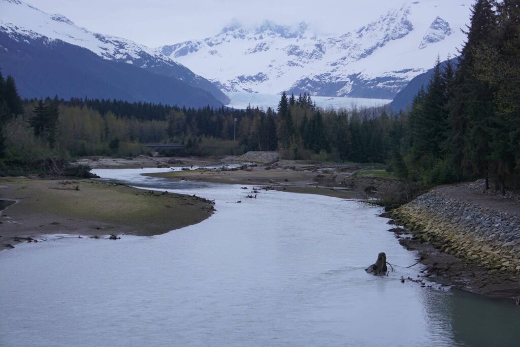
Though the Mendenhall River flowing by their backyard had been swollen with floodwaters in past years – and though the Lindoffs had taken precautions last summer like sealing doorways and stacking sandbags – the Aug. 5-6, 2024, event was the biggest Mendenhall Glacier outburst flood ever measured. The water that rushed out of a breached glacial ice dam brought the river to a record crest of 15.99 feet, inundating about 290 homes and stunning much of the community.


“No one expected it to be this big,” Lindoff said months later in an interview at her freshly repaired and refurbished house.
The community is no longer likely to be caught by surprise.
“It’s probably likely that the floods could get larger in the future,” said Eran Hood, an environmental science professor and glacier specialist at the University of Alaska Southeast.
Hood is part of a broad effort mounted by scientists, government agencies, the local Tribal government, nonprofit community groups and individuals to limit the damage that may result from future floods.

A first step is ensuring that the public knows the risks. To that end, Hood and others at UAS and partner organizations have created an online resource, the Juneau Glacial Flood Dashboard, launched in May.
Though the floods glaciers produce can happen quickly, there can be early warnings of water releases. The Juneau Glacial Flood Dashboard gives real-time information on water levels pooled above the ice dam that forms each year at one of the glacier’s basins. It has weather data, aerial images and other up-to-the-minute information. One of the most important features is a detailed flood-inundation map; users can type in their addresses and get predictions for flood impacts, depending on river-level scenarios and other conditions.
The dashboard idea came up as an answer to a basic question, Hood said: “What are the best ways to communicate hazards?”
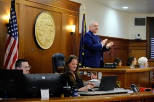
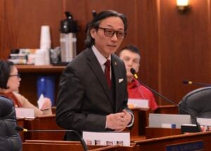
Lawmakers consider an only-in-Alaska flood insurance programWork by Hood and his colleagues is supported by a National Science Foundation grant. The foundation funded a project to do detailed studies of Mendenhall Glacier and the flood risks it poses, hone systems for predictions and warnings and apply those tools to other flood-prone glaciers in Alaska and possibly beyond.
Outburst flooding is a natural phenomenon in glaciated areas, sometimes referred to by an Icelandic name: jökulhlaup. They occur from the Andes to the Arctic. Their suddenness can make them dangerous to people in certain parts of the world, like the Himalayas; overall, about 15 million people in the world are at risk of such floods, according to a 2023 study published in the journal Nature.
The risks are increasing with climate change and glacial melt, studies have shown. Globally, glacial lake volume increased by 48% between 1990 and 2018, according to a 2020 study by Canadian, U.S. and British scientists who used satellite imagery to make the calculations.
Alaska outburst floods
Glacial outburst floods are also natural in Alaska, though the trends are a bit different.
There were 1,150 of these outbursts released from 106 ice-dammed lakes between 1985 and 2020, according to a study published in 2023 by scientists from Colorado State University, the University of Alaska Fairbanks and other institutions. The frequency of such events was unchanged over that period, they found. But there was a big change in timing, with most of the sites flooding earlier in the year, likely the result of warming temperatures and faster melt, the study found. Rapid changes in glaciers’ structures also means that new water-filled dams — and new flood risks — are emerging at individual sites, the study said.

Alaska’s glaciers are melting faster than those elsewhere in the world. The melt has varied and sometimes contradictory impacts on outburst floods, the 2023 study explains. Less ice overall has meant a reduced supply of meltwater. But accelerated melt can also increase the size of glaciers’ basins and weaken the ice dams that hold their meltwater. Rapid melt can also cause huge chunks of ice to calve away from higher elevations into the basins, boosting volume quickly.

Most of Alaska’s outburst floods have occurred in remote areas where there are no immediate threats to communities, like parts of sprawling Wrangell St-Elias National Park.
The Mendenhall Valley, however, is not remote.
The broad valley was carved into the landscape over millennia by its namesake glacier. It is a major suburb of Alaska’s capital city, home to about 12,000 of Juneau’s 31,200 residents. It holds neat neighborhoods where houses are more spacious than in the city’s upscale but tightly packed downtown district. It also holds abundant parks and trails, scenic views of mountains, meadows and coastline; and conveniences like shopping malls and commuter bus service. And, within the Tongass National Forest that surrounds the city, the valley is known for the big glacier that looms over it and draws hundreds of thousands of tourists each year.
Mendenhall Glacier has ebbed and flowed over thousands of years, but it has been in retreat ever since the Little Ice Age ended in the mid-1700s. As the climate has warmed — a trend amplified in far-north latitudes — the retreat has accelerated. That is the case not just for Mendenhall but for the other glaciers connected to the vast Juneau Ice Field that caps the mountains spanning Southeast Alaska and adjacent parts of Canada. The Juneau Ice Field lost a tenth of its glacier area from 2005 to 2019, according to NASA.
This melt created a relatively new gap within Mendenhall’s ice called Suicide Basin, reportedly named after the drop that ice above the basin would experience. Retreat of the smaller Suicide Glacier, which had been connected to Mendenhall, created the gap.
As glacial ice melts over each summer, the basin fills with water. As the water within the basin rises, it breaks through the ice dam and rushes down into Mendenhall Lake, Mendenhall River and, sometimes, over the riverbanks. The process is repeated year-to-year as ice dams are formed and then breached, though water amounts and speed of releases can vary.
Had modern technology and alertness existed in the past, the risk to the Mendenhall Valley could have been identified many years ago, Hood said.

“Twenty years ago, someone could have looked at Mendenhall and looked at the side basins and said there could definitely be a problem in the future. Nobody did that,” he said.
The first Suicide Basin outburst flood was in 2011. “That pretty much caught people by surprise, although in hindsight, it shouldn’t have,” said Jason Amundson, a UAS geophysics professor and the principal investigator for the National Science Foundation-funded project.
Since then, floods have occurred almost annually, though at varying levels and intensities. Recent floods were big. A record 2023 flood, with a maximum crest of the Mendenhall River measured at 14.97 feet, was followed by the even-bigger 2024 flood.
Though it caused more damage, last year’s flood came and went quickly. “The whole thing lasted maybe 12 hours,” Amundson said..


There is not yet enough data to identify a clear pattern, making predictions difficult for now, Hood and Amundson said. But there is a good chance that Suicide Basin will continue emptying out huge amounts of water.
“If we keep having full drainage like we did last year, then I would expect that we would keep having big floods,” Amundson said.
Local officials, meanwhile, are looking beyond Suicide Basin as they consider future risks, said Robert Barr, Juneau’s assistant city manager.
“There very well could be other basins behind Suicide that will form as Mendenhall Glacier retreats,” he said.
Holding waters back
The municipal government, a partner in the flood dashboard, has embarked on another short-term response to the flood risk.


It spent nearly $8 million on a flood barrier erected this year along the Mendenhall River. The barrier, a stout sandbag structure originally designed for military use, was recommended by the U.S. Army Corps of Engineers as a short-term fix. To recoup part of the cost, the local government is assessing a fee on the 466 property owners in the river area. The fee, about $6,300 per household, is to be paid over 10 years.
The Lindoff home is among those behind the new barrier, which bears the brand name HESCO. Danielle Lindoff, who has watched river waters rise and churn over the years, eroding the far bank and felling huge trees, said she is grateful for the protection. But her feelings are mixed.
“We bought this house because of the view,” she said. “Now we won’t even be able to see it.”
Barr, at the City and Borough of Juneau, concedes the barriers are not particularly pretty. But he said most homeowners accept their presence.
“I wouldn’t say the question was, ‘Do you find the HESCO barriers attractive or not?’” he said. “But they are our best effort, in consultation with the Army Corps and all the other experts that we’re talking with, to keep water in the river.”

The barriers are temporary, Barr said.
For the longer term, the Army Corps of Engineers might design a bigger flood-control system, he said. That could be something as substantial as the diversion project installed in Fairbanks after a devastating 1967 flood. The Fairbanks system is large, subject to ongoing maintenance, and has cost $220 million to date. The Corps has already embarked on a technical study for the Mendenhall Valley, a project supported by $4.75 million in federal funds.

Whatever is done will depend on scientific research.
The University of Alaska Southeast-led team, which also includes scientists from the University of Alaska Fairbanks and Carnegie Mellon University, is using field and remote-sensing data to better understand how the glacier has changed in the past and to create models for how it will change in the future. Technologies used include LiDAR, which measures elevations and features through light beams; radar, which employs soundwaves to measure the thickness of glacial ice over bedrock; and drones, which capture aerial images that can be compared over time.Weather and tide data is important, too. The record 2024 outburst flood came on a night after a gloriously sunny and warm summer day. Things could be much worse if an outburst flood happens during a rainstorm or when tides in the adjacent Gastineau Channel are exceptionally high, experts say.
Beyond Juneau
The Mendenhall work being led by Amundson is about more than Juneau’s famous glacier. The risk-analysis systems the team develops for Mendenhall are intended to be applied to other glaciers in Alaska.
Beyond Mendenhall, Hood said, the second-highest priority for risk analysis is probably Snow Glacier on the Kenai Peninsula south of Anchorage and just north of the coastal town of Seward.

Though the Snow Glacier’s periodic floods have not reached communities beyond a popular campground and a smattering of nearby houses, they do threaten infrastructure. The Seward Highway, a major state thoroughfare, and the Alaska Railroad run right along that flood zone. The railroad is planning to raise the elevation of a bridge at the trouble site, and the Alaska Department of Transportation plans a related elevation rise to the highway. The estimated cost of the road project alone is $20 million.

Hood and Amundson pointed out another spot where glacial outburst floods are threats: the Prince William Sound port town of Valdez, home to 3,900 people and site of the terminal where oil that passes through the Trans Alaska Pipeline System is shipped out.
In the mountains outside of town, the Valdez Glacier has been damming and releasing meltwater every year or two. Some years, releases are relatively slow and small; some years’ releases cause problems. An outburst flood in 2018 inundated part of Valdez.
Weakened federal partners?
Continued work to understand glacial outburst floods and the risks they pose to Alaskans depends on partnerships with academic institutions and agencies at various levels of government.
But federal agencies that are important partners have been weakened by deep budget cuts and abrupt firings that could hollow out scientific programs.
One partner is the U.S. Geological Survey, a branch of the Department of the Interior that has been doing both long-term monitoring of Mendenhall Glacier’s changes and collecting day-to-day data and imagery from Suicide Basin. The Trump administration is proposing slashing total USGS spending by nearly 40%, including an approximately 30% cut to the agency’s natural disaster programs.
The National Oceanic and Atmospheric Administration, which houses the National Weather Service, is another key partner that has already been targeted for deep cuts and likely faces more. The administration’s budget for the coming fiscal years proposes eliminating all funding for NOAA research.
The U.S. Forest Service is another partner. It manages the Tongass National Forest, which covers most of Southeast Alaska, and Southcentral Alaska’s Chugach National Forest. Both are heavily glaciated.


Among the Forest Service duties in Juneau is delivery of warnings and, at times, evacuation notices to tourists and campers at the Mendenhall Glacier Visitor Center. Mass firings by the Trump administration left the visitor center nearly unmanned earlier in the year, with only two employees still on the payroll there in February. Several workers have been rehired since, but staffing levels remain uncertain.
Barr said Juneau officials worry about losses at the Federal Emergency Management Agency, an important partner even though its general definition of flood zones does not consider glacial outburst floods.
The agency in April canceled its Building Resilient Infrastructure and Communities grant program, and halted work on all pending grant applications, even though the program has won praise for helping communities reduce costs of disaster emergencies.
Several states are pushing back against the program’s termination; 20 filed a lawsuit in mid-July challenging the administration’s decision.
“We are potentially concerned about hazard-mitigation grants and those going away,” Barr said. And along with loss of financial aid is the concern about “losing expertise” as veteran emergency and risk-assessment experts are pushed out of the agency, he said.
Uncertainty also affects the National Science Foundation, which is funding the Mendenhall research project. The Trump administration is proposing a 55 percent cut for the coming fiscal year.
The grant money was already paid, and so far, the project has remained intact, Amundson said. “As far as I know, everything is going forward,” he said.

This story has been supported by the Solutions Journalism Network, a nonprofit organization dedicated to rigorous and compelling reporting about responses to social problems, http://solutionsjournalism.org.