






NOTN- Local, tribal, state and federal officials say Juneau is better protected but still at risk as the community braces for another glacial lake outburst flood from Suicide Basin in early August.
City Manager Katie Koester at a media briefing this morning, emphasized to reporters and media outlets that the purpose of the meeting as well as upcoming community events surrounding flood protection work is all about keeping residents informed and prepared ahead of this year’s Glacial Lake Outburst Flood, or GLOF.
She said the key takeaway however, was the need to evacuate during the event.
“We’ve done a lot to prepare for this event and we really appreciate the partnership with the Army Corps of Engineers in installing essentially between the city and the Army Corps $45 million worth of protective infrastructure for this year.” Koester said, “Nevertheless, it’s an unpredictable event, and if we have a breach, it will be a flash flood, and it will be very dangerous.”
The National Weather Service says Suicide Basin water levels are tracking close to 2024. Senior service hydrologist Aaron Jacobs said the basin is about 90 feet below the spillway and is most likely to fill between Aug. 1 and Aug. 9.
Forecasts point to a major flood similar to last year if the basin releases at full volume.
“We’re very close to the levels that we were seeing in 2024 and typically we’ll see about a three foot rise in normal inflow into the basin, and so right now we are about 90 feet below that spillway.” Jacobs said, “Right now that’s about 30 days out before we could see a full basin, and on our monitoring page we do update the conditions weekly, and if we see any other conditions change, we will update it more frequently.”
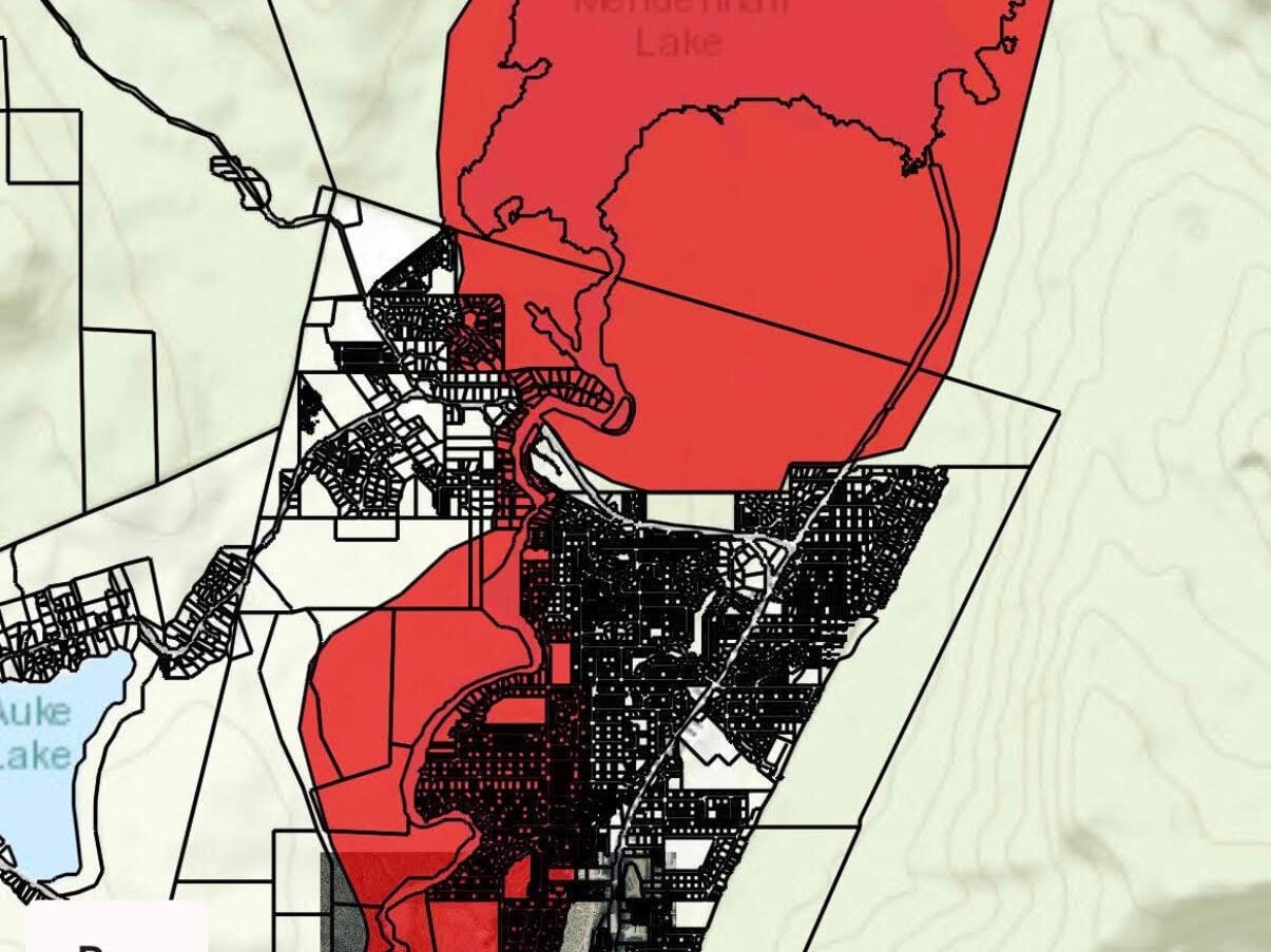
The City and Borough of Juneau has expanded its evacuation advisory zone to cover just over 1,900 residences, up from about 1,000 last year, based on new evacuation maps that account for blocked roads and responder access. Residents will be guided through a “ready, set, go” framework with Wireless Emergency Alerts, siren-style phone notifications and door hangers in affected neighborhoods.
“In years past, the CBJ and Unified Command have used inundation maps to communicate the risk from from potential flooding and the need to evacuate this year.” Said Emergency Programs Manager Ryan O’Shaughnessy, “We’ve worked really closely with all of our partners to plan for all scenarios, including the potential failure of the HESCO system. Our evacuation map this year, you’ll notice, has a lot more straight lines than an inundation map, and is generally aligned with streets and infrastructure, and the reason for that is we wanted to include areas that may not be directly inundated, but where access or travel, including by first responders, may be compromised. So in other words, if we wouldn’t be able to get to you during a breach scenario, or if you may not be able to get to safety, we are recommending that you evacuate.”
Engineers say roughly $45 million in temporary flood protection including HESCO barriers and a large pump system is now in place along the river through a partnership between the city and the U.S. Army Corps of Engineers.
“We have a very high level of confidence in the HESCO barriers, but this is a dynamic event… we really want to stress for folks to evacuate during this event,” said O’Shaughnessy.
Information on evacuation maps, sandbag events, and alerts is available on the Juneau Flood Ready page at juneau.gov.